

Urban Analytics with Python

Urban Analytics with Python
Published 9/2024
Duration: 4h28m | .MP4 1280x720, 30 fps(r) | AAC, 44100 Hz, 2ch | 3.38 GB
Genre: eLearning | Language: English
Published 9/2024
Duration: 4h28m | .MP4 1280x720, 30 fps(r) | AAC, 44100 Hz, 2ch | 3.38 GB
Genre: eLearning | Language: English
Geospatial Data Science and OpenStreetMap
What you'll learn
Learn the basics of geospatial data science, in particular, how to recognize and manipulate vector data in Python
How to collect and store various vector data from OpenStreetMap using customizable automatic ways in Python
How to use spatial analytics to quantify relevant urban features and characteristics from vector data
How to merge and quantify various vector data coming from OpenStreetMap to derive livability analytics of urban areas
Requirements
Functional knowledge of Python
Basic understanding of GIS concepts
Description
Introduction
Welcome to "
Urban Analytics with Python: Geospatial Data Science and OpenStreetMap
"! In this course, you'll dive deep into the world of urban data analysis with a hands-on Python coding approach. This isn't just a theoretical overview – it's a practical course where you'll actively write code to manipulate, analyze, and visualize geospatial data from OpenStreetMap (OSM).
The course starts with an introduction to geospatial data, including the distinctions between vector and raster data types, while offering a foundation in using OSM as a robust data source. As you move forward, we'll guide you through setting up your Python environment and introduce essential geospatial libraries like GeoPandas and Shapely. You’ll begin coding right away, working with geometric data types and handling geospatial data structures.
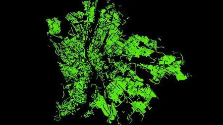
Once you’re comfortable with Python and geospatial basics, we’ll focus on acquiring different urban datasets from OSM using powerful Python packages like OSMNx and OverPy. You’ll learn how to collect and work with point, polygon, and graph data, from building footprints to road networks. Every step will involve Python coding, ensuring you gain the technical skills to handle real-world geospatial data tasks.
Finally, we’ll wrap up with advanced urban analytics techniques. You’ll engage in practical projects, analyzing road networks, building profiles, and creating visualizations to explore urban areas. The course concludes with a comprehensive mini-project, where you’ll apply all the techniques you’ve learned to create a livability index for a city, combining various urban KPIs using Python.
By the end, you'll have a solid grasp of geospatial data science and be able to use Python and OSM data to conduct advanced urban analytics projects. Let’s get coding and unlock the power of urban data together!
And what you get here:
- Chapter intro and summary videos directly with the author
- Presentations with PDF supplementary slides
- Coding videos with screen sharing, which comes with the recorded live code files as well as cleaned-up version fo the odes in Jupyter Notebook formats
Who this course is for:
Data scientists interested in expanding their skills toward the trending field of spatial and urban analytics
GIS analytics and urban planners interested in getting on-board with topical data science tools
More Info