Introduction to Geographic Information System (GIS)
Introduction to Geographic Information System (GIS)
MP4 | Video: AVC 1280x720 | Audio: AAC 44KHz 2ch | Duration: 44M | 479 MB
Genre: eLearning | Language: English
MP4 | Video: AVC 1280x720 | Audio: AAC 44KHz 2ch | Duration: 44M | 479 MB
Genre: eLearning | Language: English
Learn GIS, remote sensing, sources of spatial data, mapping and cloud based big data analysis.
INTRODUCTION TO GIS FOR BEGINNERS: Learn both the theoretical knowledge and practical skills of the latest GIS technologies with easy to follow video lectures and laboratory exercises.
This course provides an introduction to GIS, sources of GIS data, GIS data structure and and hands-on practical exercises to processing, downloading, and visualizing large volume of geospatial data in Google Earth Engine platform. Specifically we will cover:
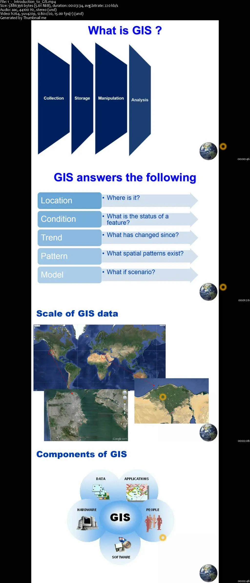
Introduction to GIS
GIS data structure
Sources of GIS data
Earth observation data
GIS data access
No prior experience required. All are tailored such that anyone can follow them easily.
To date the ability to have skills in GIS technologies is key to various decision makings. This course will provide you the necessary skills on how to manipulate and utilize a GIS data for your own purpose.
In my course, I will give you the tools and skills through a step-by-step lecture and lab exercises. You will understand the fundamentals of GIS and gain skills on manipulating earth observation data. Students will learn the different concepts in a GIS including sources of GIS data, GIS data structure, functions of a GIS and applications to GIS. Example earth observation satellite data will be used through out the course.
Introduction to Geographic Information System (GIS)