

Machine Learning for GIS: Land Use/Land Cover Image Analysis
Machine Learning for GIS: Land Use/Land Cover Image Analysis
Video: .mp4 (1280x720, 30 fps(r)) | Audio: aac, 44100 Hz, 2ch | Size: 2.31 GB
Genre: eLearning Video | Duration: 31 lectures (4 hour, 4 mins) | Language: English
Video: .mp4 (1280x720, 30 fps(r)) | Audio: aac, 44100 Hz, 2ch | Size: 2.31 GB
Genre: eLearning Video | Duration: 31 lectures (4 hour, 4 mins) | Language: English
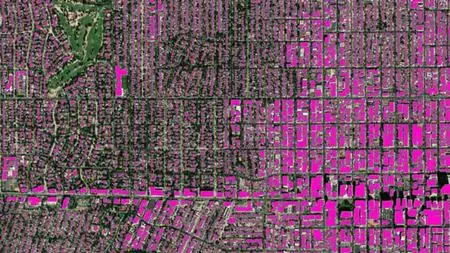
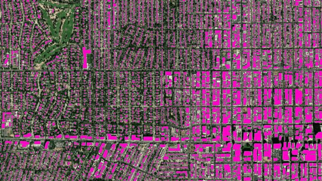
Become Expert in advanced Remote Sensing/GIS pixel-based & and object-based image analysis in Google Earth Engine & QGIS.
What you'll learn
Fully understand advanced methods of Land use and Land Cover (LULC) Mapping in QGIS and Google Earth Engine
Learn how to perform such advanced methods as object based image analysis (OBIA) and object-based classification using real-world data in QGIS
Further advanced your skills in the most popular open-source GIS and Remote Sensing software tools (QGIS)
Learn how to obtain satellite data, apply image pre-processing, create training and validation data for OBIA in QGIS and Google Earth Engine
Apply advanced Machine Learning image classification algorithms
Create and download LULC maps for your report
Explore the power of Google Earth Engine for image analysis
You'll also have plenty of handy hints and tips will be provided alongside the code to prevent glitches
You'll have a copy of the labs’ step-by-step manuals used in the course for your reference to use in for their analysis.
Requirements
A vivid interest in working with geospatial data
Basic knowledge of manipulating spatial (image) data using QGIS
A working computer with internet connection
• The course will be demonstrated using a QGIS version of Windows PC. Mac and Linux users will have to adapt the instructions to their operating systems.
Description
[Advanced] Land Use/Land Cover mapping with Machine Learning
This course is designed to take users who use QGIS for basic geospatial data/GIS/Remote Sensing analysis to perform more advanced geospatial analysis tasks including object-based image analysis using a variety of different data and applying Machine Learning state of the art algorithms. In addition to making you proficient in QGIS for spatial data analysis, you will be introduced to another powerful processing toolbox – Orfeo Toolbox and to the exciting capabilities of Google Earth Engine!
I'm very excited that you found my LULC Advanced course. This course is designed to equip you with the practical knowledge of advanced Land Use and Land Cover (LULC) mapping, which is one of the core skills for any Geographic Information Systems (GIS) and Remote Sensing analyst. By the end of the course, you will feel confident and completely understand and apply advanced Geospatial analysis including performing Machine Learning algorithms for land use and land cover mapping and learning object-based image analysis and basics of segmentation. All this you will be able to carry out on the real data in one of the most popular GIS software which is QGIS and Google Earth Engine.
This course is different from other training resources. Each lecture seeks to enhance your GIS and Remote Sensing skills in a demonstrable and easy-to-follow manner and provide you with practically implementable solutions. You’ll be able to start analyzing spatial data for your own projects, and gain appreciation from your future employers with your advances GIS skills and knowledge of the cutting edge LULC techniques.
In the course, you will be able to learn how to carry out all stages of LULC mapping from acquiring satellite data to assessing the accuracy of your map and design a beautiful change map readily available to be inserted in your document or report.
The course is ideal for professionals such as geographers, programmers, social scientists, geologists, and all other experts who need to use LULC maps in their field and would like to learn fundamentals of LULC and change detection in GIS. If you're planning to undertake a task that requires to use a state of the art classification algorithms for creating, for instance, land cover and land use maps, this course will give you the confidence you need to understand and solve such geospatial problem.
One important part of the course is the practical exercises. You will be given some precise instructions, codes, and datasets to create LULC maps and change maps using the QGIS software and Google Earth Engine.
In this course, I include downloadable practical materials that will teach you:
- How to install open source GIS software (QGIS and Orfeo toolbox) on your computer and correctly configure it
- QGIS software interface including its main components and plug-ins
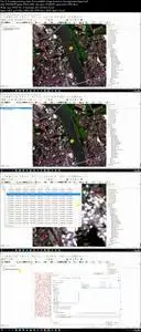
- Learn how to classify satellite images with different machine learning algorithms in QGIS
- Learn how to perform training, validation data collection and accuracy assessment
- Learn how to perform object-based image analysis
- Learn how to perform object-based crop type mapping in QGIS
- Learn how to run supervised and unsupervised Machine Learning Algorithms in Google Earth Engine
INCLUDED IN THE COURSE: You will have access to all the data used in the course, along with the Java code files. You will also have access to future resources. Enroll in the course today & take advantage of these special materials!
Who this course is for:
Geographers, Programmers, geologists, biologists, social scientists, or every other expert who deals with GIS maps in their field
Machine Learning for GIS: Land Use/Land Cover Image Analysis
