

Webgis: From Beginner To Advance
Webgis: From Beginner To Advance
Published 9/2024
MP4 | Video: h264, 1920x1080 | Audio: AAC, 44.1 KHz
Language: English | Size: 15.32 GB | Duration: 18h 0m
Published 9/2024
MP4 | Video: h264, 1920x1080 | Audio: AAC, 44.1 KHz
Language: English | Size: 15.32 GB | Duration: 18h 0m
Developing Interactive GIS Platforms with Server Side Technologies
What you'll learn
Fundamentals of web development with HTML, CSS, and Bootstrap.
Developing interactive user interfaces using JavaScript and jQuery.
How to use Leaflet and its plugins to create functional web maps.
Loading, styling, and displaying your own data in a WebGIS environment.
Querying spatial data and displaying the results separately in WebGIS.
Hosting PostgreSQL on both local systems and cloud platforms.
Storing and retrieving spatial data from PostgreSQL databases.
Basic SQL commands to interact with databases.
Using server-side scripting with PHP.
Performing real-time data updates, inserts, and deletes in a WebGIS system.
Implementing a tile-based approach to display raster data on WebGIS platforms.
Setting up hosting services to make your WebGIS accessible from anywhere in the world.
Requirements
You need to have a working knowledge on GIS. If you can make some maps using ArcGIS or QGIS, then it is good enough.
No programming experience needed. I will teach you everything step by step.
Description
This course is designed for anyone who wants to learn WebGIS from the ground up, even if you’re starting from scratch. While there are many WebGIS courses out there, few provide a complete, structured path from beginner to advanced levels. Most courses focus on either beginners or experts, but this course takes you on a comprehensive journey that covers everything—from the basics to more advanced concepts.No prior programming experience is necessary. Everything is taught step by step, with a focus on building your skills progressively. You don’t need to be a GIS expert; as long as you have a desire to learn, you’ll be ready to succeed.In this course, I will guide you through:HTMLCSSJavaScriptBootstrapjQueryLeafletPHPPostgreSQLPostGISSQLGDALBy the end of the course, you will have gained the skills to combine both client-side and server-side technologies to create a fully functional WebGIS system. You’ll be able to handle real-time data insertion, updates, and deletion operations efficiently. Users will be able to query data seamlessly through an intuitive Graphical User Interface (GUI) that you design.And finally, we’ll make your WebGIS system accessible from anywhere in the world, ensuring that your data and tools are available to anyone, anytime!
Overview
Section 1: Introduction
Lecture 1 Introduction to the Course
Lecture 2 What is WebGIS?
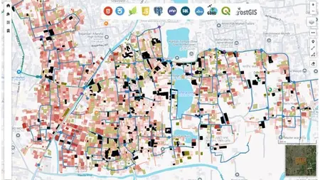
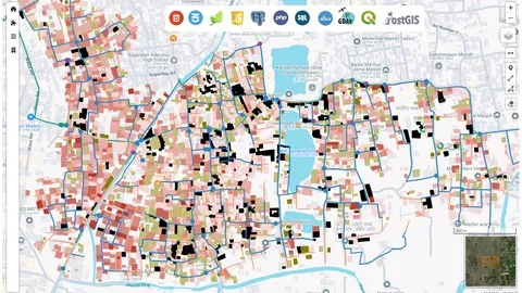
Lecture 3 Final WebGIS Portal that We Will Develope
Section 2: HTML
Lecture 4 Installing Xampp
Lecture 5 Installing Sublime Text
Lecture 6 HTML Basics (Part-1)
Lecture 7 HTML Basics (Part-2)
Section 3: CSS and Bootstrap
Lecture 8 CSS Basics
Lecture 9 Bootstrap Basics (Part-1)
Lecture 10 Bootstrap Basics (Part-2)
Section 4: JavaScript and jQuery
Lecture 11 JavaScript Basics (Part-1)
Lecture 12 JavaScript Basics (Part-2)
Lecture 13 Document Object Model (DOM) Manipulation with JavaScript
Lecture 14 Introduction to jQuery
Lecture 15 JavaScript Problem Solving
Section 5: Your First Webmap with Leaflet
Lecture 16 Introduction to Mapping Libraries
Lecture 17 Introduction to Leaflet
Lecture 18 Initiating First Webmap (Part-1)
Lecture 19 Initiating First Webmap (Part-2)
Lecture 20 Adding Multiple Basemaps
Lecture 21 Leaflet Plugins (Sidebar, Easy Button, Scale Bar)
Lecture 22 Leaflet Plugins (Mearure Tool and Mouse Position)
Lecture 23 Leaflet Plugins (Draw Control and Minimap)
Lecture 24 Leaflet Map Controls (Zoom and Layer Control)
Lecture 25 Introduction to GeoJSON
Lecture 26 Advantages of GeoJSON and Validating it
Lecture 27 Loading Point Features in Leaflet
Lecture 28 Styling Point Features in Leaflet
Lecture 29 Loading and Styling Line Features in Leaflet
Lecture 30 Loading and Styling Polygon Features in Leaflet
Lecture 31 Developing and Creating Contents in the Sidebar
Lecture 32 Attribute Query in Leaflet
Lecture 33 Querying and Displaying Point Features
Lecture 34 Querying and Displaying Line Features
Lecture 35 Querying and Displaying Polygon Features
Section 6: Getting Started with PostgreSQL and PostGIS
Lecture 36 Introduction to PostgreSQL and PostGIS
Lecture 37 How to Install PostgreSQL and PostGIS
Lecture 38 Set Up PostgreSQL with PostGIS and Connect to QGIS
Lecture 39 Uploading Spatial Data to PostgreSQL
Section 7: Essential SQL Skills for WebGIS Development
Lecture 40 Introduction to SQL and Create Operation
Lecture 41 Select Operations in SQL
Lecture 42 Update Statements in SQL
Lecture 43 Delete Operations in SQL
Lecture 44 Some Necessary Commands in SQL
Lecture 45 Data Cleaning (Part-1)
Lecture 46 Data Cleaning (Part-2)
Section 8: Advance PostgreSQL Operations for WebGIS Development
Lecture 47 Introduction to Cloud Based PostgreSQL Instances
Lecture 48 Creating a Free PostgreSQL Instance on the Cloud
Lecture 49 Connecting with the Remote PostgreSQL Instance
Lecture 50 Loading Data into Remote PostgreSQL Instance and Creating Backups
Lecture 51 Creating Spatial Indexing in PostgreSQL
Section 9: Server Side Language (PHP)
Lecture 52 PHP Basics for Developing WebGIS Portals
Lecture 53 Performing GET and POST Request in PHP
Lecture 54 Establishing Connection with PostgreSQL Instance and Reading Data
Lecture 55 Data Validation and Insert Data into PostgreSQL (Part-1)
Lecture 56 Data Validation and Insert Data into PostgreSQL (Part-2)
Lecture 57 Data Validation and Insert Data into PostgreSQL (Part-3)
Section 10: Full Fledge WebGIS Portal with Server Side Technologies
Lecture 58 Modifying Graphical User Interface (Part-1)
Lecture 59 Modifying Graphical User Interface (Part-2)
Lecture 60 Loading and Displaying Point Features from Server (Part-1)
Lecture 61 Loading and Displaying Point Features from Server (Part-2)
Lecture 62 Loading and Displaying Point Features from Server (Part-3)
Lecture 63 Loading and Displaying Point Features from Server (Part-4)
Lecture 64 Loading and Displaying MultiLine and MultiPolygon Features from Server
Lecture 65 Querying Database and Displaying the Result (Part-1)
Lecture 66 Querying Database and Displaying the Result (Part-2)
Lecture 67 Querying Database and Displaying the Result (Part-3)
Lecture 68 Modifying User Interface for Data Insertion
Lecture 69 Creating GeoJSON from Draw Controls or Geoman
Lecture 70 Real Time Data Insertion (Part-1)
Lecture 71 Real Time Data Insertion (Part-2)
Lecture 72 Automatic Data Syncing Amount Multiple Systems
Lecture 73 Real Time Data Insertion (Part-3)
Lecture 74 Real Time Data Insertion (Part-4)
Lecture 75 Modifying User Interface for Data Updating
Lecture 76 Real Time Data Update and Delete (Part-1)
Lecture 77 Real Time Data Update and Delete (Part-2)
Lecture 78 Real Time Data Update and Delete (Part-3)
Lecture 79 Integrating Sweet Alert into WebGIS Portal
Lecture 80 Real Time Data Update and Delete (Part-4)
Lecture 81 Real Time Data Update and Delete (Part-5)
Lecture 82 CRUD Operations Completed
Lecture 83 Filtering Multiple Study Areas (Part-1)
Lecture 84 Filtering Multiple Study Areas (Part-2)
Lecture 85 Filtering Multiple Study Areas (Part-3)
Section 11: Displaying Raster Data on WebGIS Portal
Lecture 86 What is Tiling?
Lecture 87 Preparing Raster Data
Lecture 88 Making Tiles from Raster Data
Lecture 89 Displaying Raster Data
Section 12: Hosting the WebGIS System
Lecture 90 Getting a Hosting and Domain Name
Lecture 91 Bringing the WebGIS Portal Online
Lecture 92 Ending Remarks
Section 13: Additional Contents
Lecture 93 Shortcut to Upload Raster Data to Hosting
GIS Professionals.,Students willing to learn advanced GIS.,Basically for anyone who is interested in mapping and want to develop his/her skills in GIS.