

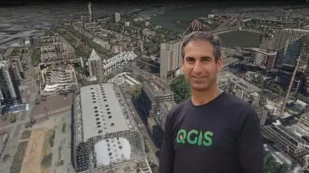
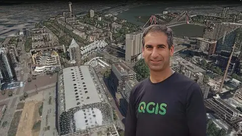
Point Cloud Processing And 3D Visualization With Qgis
Point Cloud Processing And 3D Visualization With Qgis
Published 1/2024
MP4 | Video: h264, 1920x1080 | Audio: AAC, 44.1 KHz
Language: English | Size: 2.24 GB | Duration: 1h 33m
Published 1/2024
MP4 | Video: h264, 1920x1080 | Audio: AAC, 44.1 KHz
Language: English | Size: 2.24 GB | Duration: 1h 33m
Unlock the potential of point cloud data in QGIS with its new processing tools, 3D rendering features and PDAL wrench.
What you'll learn
Define point cloud data
Find point cloud data sources and tools
Create and use Virtual Point Clouds (VPC)
Interpolate point cloud data to raster
Visualize point cloud data in 2D and 3D
Filter point cloud data
Automate point cloud processing with PDAL wrench
Requirements
Good computer skills, basic knowledge of the command line
The course assumes that the participants have some basic knowledge of QGIS and GIS concepts, but no prior experience with point cloud data is required.
You'll need QGIS 3.34 or newer. The course provides installation instructions for Microsoft Windows only. Installation for other operating systems is not covered by the course.
For this course you need to have a computer with a good graphics card. 16 GB RAM and a large hard disk are recommended.
Description
Welcome to this course on point cloud processing and 3D visualization with QGIS!If you are a QGIS user who is eager to improve your skills by learning how to handle point cloud data, this course is for you.In this course you will learn how to:Download and preprocess point cloud data from various sourcesInterpolate point cloud data to create digital elevation models and other raster productsVisualize point cloud data in 3D using the QGIS 3D view and Elevation Profile toolFilter point cloud dataAutomate point cloud processing workflows using PDAL wrenchThe course is structured into 8 sections, each containing videos, quizzes, and assignments to help you master the concepts and techniques. You will use only open data and QGIS throughout the course. By the end of the course, you will have a solid foundation in point cloud processing and 3D mapping, and you will be able to create stunning 3D scenes of your study area!I assume that you are a Windows user. All instructions are for Windows. If you're using another operating system and get stuck, you need to find solutions on the internet.I hope you are excited to join this course and discover the power of QGIS and point clouds. To get a glimpse of what you will learn, please watch the course promo video and check out the free previews. I can’t wait to see you on the course!
Overview
Section 1: Introduction
Lecture 1 Introduction
Lecture 2 Install QGIS
Section 2: Theory of Point Cloud Data
Lecture 3 Theory of Point Cloud Data
Section 3: Download and Preprocess Point Cloud Data
Lecture 4 Point Cloud Data Sources
Lecture 5 Download Point Cloud Data and Load in QGIS
Lecture 6 Check Point Cloud Properties
Lecture 7 What is a Virtual Point Cloud (VPC) layer?
Lecture 8 Build a Virtual Point Cloud Layer
Lecture 9 Clip Point Cloud Data
Lecture 10 Create a COPC Layer
Lecture 11 Assign a Projection to a Point Cloud Layer
Section 4: Interpolate Point Cloud Data
Lecture 12 Introduction to Interpolation of Point Cloud Data
Lecture 13 Interpolate with IDW
Lecture 14 Interpolate Voids
Lecture 15 Interpolate with TIN
Section 5: Visualize point cloud data
Lecture 16 Introduction to Visualization of Point Cloud Data
Lecture 17 Create Map Themes
Lecture 18 Compare Two 2D Map Views
Lecture 19 The Elevation Profile Tool
Lecture 20 Using the 3D Map View
Section 6: Filter Point Cloud Data
Lecture 21 Introduction to Filtering Point Cloud Data
Lecture 22 Check the statistics of point cloud attributes
Lecture 23 Filter point clouds with the classification attribute
Lecture 24 Filter point clouds using expressions
Lecture 25 Using filters in other QGIS point cloud tools
Section 7: Automate point cloud processing with PDAL wrench
Lecture 26 Setup PDAL wrench
Lecture 27 Create a VPC from tiles using PDAL wrench
Lecture 28 Clip a VPC with a polygon layer using PDAL wrench
Lecture 29 Interpolate with IDW using PDAL wrench
Lecture 30 Merge point cloud tiles using PDAL wrench
Lecture 31 Clip a LAZ file with a polygon layer using PDAL wrench
Lecture 32 Filter a LAZ file using an expression with PDAL
Lecture 33 Automate point cloud processing with PDAL wrench
Section 8: Conclusion
Lecture 34 Thanks for following this course!
The course is suitable for GIS specialists who want to explore the potential of point cloud data for spatial analysis and visualization,Urban planners,Students,Academics,Researchers