


Open Source Gis & Remote Sensing For Conservation (Beginner)
Open Source Gis & Remote Sensing For Conservation (Beginner)
Published 1/2024
MP4 | Video: h264, 1920x1080 | Audio: AAC, 44.1 KHz
Language: English | Size: 6.07 GB | Duration: 5h 58m
Published 1/2024
MP4 | Video: h264, 1920x1080 | Audio: AAC, 44.1 KHz
Language: English | Size: 6.07 GB | Duration: 5h 58m
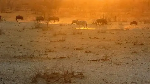
Applied course exploring practical uses of GIS and remote sensing in environment and wildlife conservation.
What you'll learn
GIS
Remote sensing
Conservation
Environmental issues
QGIS
Ecological surveys
Requirements
An interest in both conservation and GIS. No previous experience in GIS is required.
Description
This course introduces essential theoretical concepts of GIS before diving straight into practical uses of this incredible tool to support environment and wildlife conservation. It is suitable for students with limited or no knowledge of GIS, as well as those looking to refresh or enhance their skills applied to the field of conservation. Developed by Josef Clifford, an experienced GIS & remote sensing specialist, the course curriculum and content was developed in collaboration with scientists from the Wildlife Research and Training Institute of Kenya and the Zoological Society of London to ensure the content is rigorous and relevant. Real ecological survey data from Kenya, Cameroon and other locations has also been provided by these institutions which is used within practical sessions of this course. We will cover a multitude of tasks ranging from collecting and managing spatial data during ecological surveys, visualising survey data, and undertaking spatial analysis to understand spatial relationships and extract covariate data. In addition, we will see how to source free spatial data online, how to georeference images, and we will develop publication quality maps. The course will primarily utilise QGIS as well as Google Earth, whilst the advanced course (to be released in late 2024) will also make use of Google Earth Engine and R. Note that the beginner course focuses more on GIS, whilst the advanced course (to be released in late 2024) will explore remote sensing techniques in greater depth. Good luck and I hope you enjoy the course!
Overview
Section 1: Course introduction
Lecture 1 1.1. Welcome to the course!
Lecture 2 1.2. What is GIS?
Lecture 3 1.3. Components of a GIS
Lecture 4 1.4. Installing QGIS
Lecture 5 1.5. Applications of GIS and remote sensing in Conservation
Lecture 6 1.6. Why open source?
Lecture 7 1.7. Getting Started with QGIS
Lecture 8 1.9. Section 1 review
Section 2: Basic principles of GIS
Lecture 9 2.1. Introduction to section 2
Lecture 10 2.2. Spatial data types
Lecture 11 2.3. Coordinate reference systems
Lecture 12 2.4. Projected coordinate reference systems
Lecture 13 2.5. Which CRS?
Lecture 14 2.6. Sources of Spatial Data for Conservation
Lecture 15 2.8. Section 2 review
Section 3: Getting started with GIS
Lecture 16 3.1. Introduction to Section 3
Lecture 17 3.2. Sourcing data online for conservation applications
Lecture 18 3.2.x. Extra: OpenStreetMap
Lecture 19 3.3. Adding spatial data to QGIS
Lecture 20 3.3.x. Extra: Reprojecting Vector Data
Lecture 21 3.4. Extracting data
Lecture 22 3.5. Vector Styles and Labels
Lecture 23 3.6. Downloading a digital elevation model (DEM)
Lecture 24 3.7. Raster and DEM Styles
Lecture 25 3.8. Introduction to mapping and cartography
Lecture 26 3.9. Creating a publication-quality map in QGIS
Lecture 27 3.11. Section 3 review
Section 4: Working with Vector Data
Lecture 28 4.1. Introduction to section 4
Lecture 29 4.2. Georeferencing
Lecture 30 4.3. Creating new vector data and digitising
Lecture 31 4.4. Field calculations + calculating feature geometry [e.g. calculate PA areas]
Lecture 32 4.5. Summarising + analysing attribute table data [% country area protected]
Lecture 33 4.6. Choropleth Mapping
Lecture 34 4.7. Complex labelling
Lecture 35 4.9. Section 4 review
Section 5: Survey design and data collection
Lecture 36 5.1. Introduction to section 5
Lecture 37 5.2. Ecological survey design
Lecture 38 5.3. Creating survey grids and transects in QGIS
Lecture 39 5.4. Ecological survey data collection tools
Lecture 40 5.4.x. Extra: Preparing an ODK survey
Lecture 41 5.5. Loading sampling points onto a GPS device or Maps.Me on your mobile
Lecture 42 5.6. Collecting data in the field on your mobile
Lecture 43 5.7. Downloading and cleaning data
Lecture 44 5.9. Section 5 review
Section 6: Management and visualisation of Survey Data
Lecture 45 6.1. Introduction to section 6
Lecture 46 6.2. Importing and visualising data in Google Earth
Lecture 47 6.3. Importing and joining CSV data [join camera trap locations with trap rates]
Lecture 48 6.4. Merging and appending features
Lecture 49 6.5. Visualising Survey Data
Lecture 50 6.6. Interpolation and hotspot mapping
Lecture 51 6.8. Section 6 review
Section 7: Section 7: Vector Spatial Analysis
Lecture 52 7.1. Introduction to section 7
Lecture 53 7.2. Buffering [create buffer zone around protected area]
Lecture 54 7.3. Overlay tools - intersect, union, erase
Lecture 55 7.4. Spatial join
Lecture 56 7.5. Nearest Neighbour [details + distance to protected area boundary]
Lecture 57 7.6. Boolean overlay and suitability analysis [habitat suitability]
Lecture 58 7.7. Boolean overlay to enhance survey design
Lecture 59 7.9. Section 7 Review
Section 8: Final assessment
Lecture 60 Final session: congrats on completing the Beginner course!
Conservationists,Ecologists,Wildlife biologists,Conservationists,Beginners in GIS and remote sensing,Professionals in GIS interested in exploring new applications