

Mobile Gis Data Collection Apps With Leaflet And Postgis
Mobile Gis Data Collection Apps With Leaflet And Postgis
Last updated 11/2019
MP4 | Video: h264, 1280x720 | Audio: AAC, 44.1 KHz
Language: English | Size: 6.41 GB | Duration: 10h 24m
Last updated 11/2019
MP4 | Video: h264, 1280x720 | Audio: AAC, 44.1 KHz
Language: English | Size: 6.41 GB | Duration: 10h 24m
Use your phone as a GPS data collection device with no users fees or subscriptions
What you'll learn
Develop your own custom mobile data collection applications that are limited only by your imagination and don't require expensive user fees or subscriptions.
Requirements
This is not a beginner course. It expands on the content of my previous courses, particularly the courses on Server side web GIS applications and Mobile mapping applications
Description
Learn how to develop your own HTML5 GPS data collection applications that work like a native app on your mobile device. While there are many canned options available for mobile data collection that may meet your needs, there are many times when it may be more cost-effective to develop your own.Cost - Even if your needs are simple many commercial applications require monthly per-user subscriptions, often in the neighborhood of $30-$50 per month. For 1 or 2 users that may not be much but with 50 users it quickly becomes cost effective to write your own.Customizability - Commercial "non-programming" solutions tend to be one-size fits all. Although they may have some flexibility, it is not uncommon for many applications to need functionality that is not available. Writing your own mean that if you can envision it you can implement it. Often you can implement it faster than you could in a "non-programming" solution even if it is available.Real-time data access - The techniques taught in this course access a PostGIS database directly so that any changes that are made are available immediately to any other client applications whether they be desktop GIS like ArcGIS or QGIS, other web applications, or other client software such as a spreadsheet program, etc. This also means that there is no time wasted transferring data from device to server, etc which may save hundreds or even thousands of man hours in large data gathering efforts and avoid a large source of errors.HTML5 web applications also have some downsides for this type of work and these are discussed in the course and potential solutions are also addressed.
Overview
Section 1: Introduction
Lecture 1 Introduction
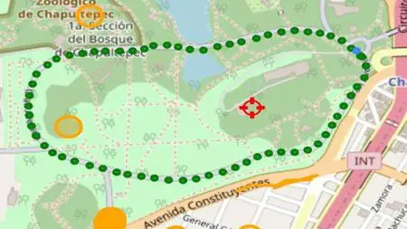
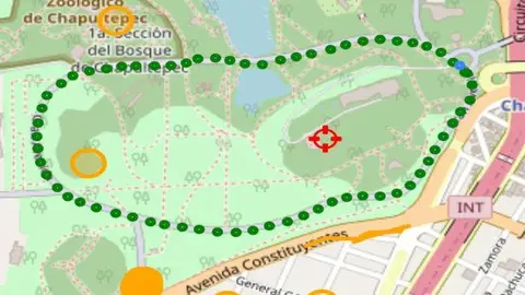
Lecture 2 Preview of the finished product
Lecture 3 Content management system setup
Lecture 4 Database setup
Section 2: Getting started
Lecture 5 Getting started
Lecture 6 Initializing the map
Lecture 7 Adding crosshairs to the map center
Lecture 8 Control Buttons
Lecture 9 Event handlers for the control buttons
Section 3: Geolocation
Lecture 10 Geolocation
Lecture 11 Going live and demonstration
Lecture 12 Turning autolocate on and off
Lecture 13 Slider to control autolocation interval
Lecture 14 The breadcrumb trail
Lecture 15 Cleaning up and testing the breadcrumb trail
Section 4: The info screen
Lecture 16 The info screen - current position
Lecture 17 The info screen - previous position
Lecture 18 The info screen - rates of change
Lecture 19 Accuracy filter - part 1
Lecture 20 Accuracy filter - part 2
Section 5: The points list
Lecture 21 Adding a popup to breadcrumbs
Lecture 22 Listing breadcrumb points - part 1
Lecture 23 Listing breadcrumb points - part 2
Lecture 24 Searching breadcrumbs
Lecture 25 Summing breadcrumb distances
Section 6: The settings screen
Lecture 26 Persisting settings to local storage
Lecture 27 Retrieving settings from local storage
Lecture 28 Going live and testing the app
Section 7: Working with the database
Lecture 29 Loading generic points - part 1
Lecture 30 Loading generic points - part 2
Lecture 31 Loading generic lines and polygons
Lecture 32 Populating the layers subscreen
Lecture 33 Populating the features list - part 1
Lecture 34 Populating the features list - part 2
Lecture 35 Finding a feature - part 1
Lecture 36 Finding a feature - part 2
Section 8: Collecting data
Lecture 37 Setting up the data collection form
Lecture 38 Collecting point data
Lecture 39 Submitting point data to PostGIS
Lecture 40 Collecting a point from a screen tap
Lecture 41 Collecting a point using the crosshairs
Lecture 42 Collecting a point using GPS averaging - part 1
Lecture 43 Collecting a point using GPS averaging - part 2
Lecture 44 Finishing touches
Lecture 45 Testing and demonstration
Section 9: Collecting lines and polygons
Lecture 46 Setting up streaming mode
Lecture 47 Setting up the stream controls
Lecture 48 Adding stream points to lyrVertices
Lecture 49 Converting the points in lyrVertices to a geojson line or polygon
Lecture 50 Submitting lines and poygons to the database
Lecture 51 Collecting lines and polygons in vertex mode
Lecture 52 Testing and demonstration
Section 10: Finishing touches
Lecture 53 Viewing the vertex points
Lecture 54 Deleting features
Lecture 55 Editing features
Lecture 56 Navigating to a feature
Section 11: Going off-line
Lecture 57 Preparing to go off-line
Lecture 58 Storing the data locally
Lecture 59 Recreating the features list from local data
Lecture 60 Recreating the features list from local data - Part 2
Lecture 61 Searching and navigating to features while offline.
Section 12: Synchronizing off-line changes to the database
Lecture 62 Preparing for synchronization
Lecture 63 Adding off-line deletions to the synchronization que
Lecture 64 Off-line updates
Lecture 65 Off-line inserts
Lecture 66 Persisting the synchronization que
Section 13: Bonus Lecture
Lecture 67 Bonus Lecture: How to get the most from my series of Udemy courses.
If you have large data collection projects and find canned mobile data collection apps too expensive and/or to inflexible, this course will show you how to create your own mobile data collection applications with no user fees or subscriptions and that you can customize to do EXACTLY what you need and nothing more.