


Marine Navigation For Seafarers
Marine Navigation For Seafarers
Published 9/2024
MP4 | Video: h264, 1920x1080 | Audio: AAC, 44.1 KHz
Language: English | Size: 3.45 GB | Duration: 6h 46m
Published 9/2024
MP4 | Video: h264, 1920x1080 | Audio: AAC, 44.1 KHz
Language: English | Size: 3.45 GB | Duration: 6h 46m
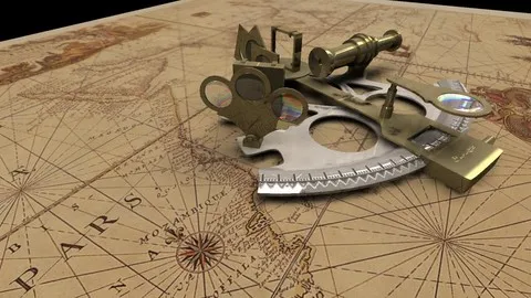
Principles and Practicles of Navigation
What you'll learn
Learn the Definition of Navigation. Publications and Equipment required onboard a ship for safe navigation.
Methods of navigation and how to become a good navigator by using various navigational equipment in the bridge
Learn the ROR (Rules of the road - The International Regulations for the Prevention of Collision at Sea, 1972) and light signals at night
Learn safe way of maneuvering vessels (E.g. ships, boats, tugs, fishing vessels or any water craft) from one place to another on the water.
Requirements
Must be a seafarer, who has been working onboard ships, boats, tugs, for a period of atleast 2 years.
Must be a Cadet Officer with atleast 2 years sea going experience onboard ships, tugs or boats
Must be an Able bodied seaman with atleast 4 years sea going experience onboard ships, tugs or boats
Must be an Ordinary seaman with atleast 4 years sea going experience onboard ships, tugs or boats
Description
Navigation is a safe way of maneuvering vessels (E.g. ships, boats, tugs, fishing vessels or any water craft) from one place to another on the water. This course explains about navigation on the water.Navigation is an Art and a Science of conducting a ship from one place to another. Navigators must refer to various nautical publications and operate different types navigational equipment carried onboard a vessel for this purpose.Every navigator must have thorough knowledge about the ROR (Rules of the road - The International Regulations for the Prevention of Collision at Sea, 1972). He or she should remember these rules by heart and should know how to apply the rules when a vessels are in sight of one another during a head on situation, crossing situation, overtaking situation, towing situation, not under command situation, passing seperation zones, passing narrow channels and at anchor. These rules must be used by each and every navigator effectively for safe navigation at sea. Entered into force 15th July 1977.Course is devided into various Lectures. They are Definition of Navigation, Rules of the road (ROR), Latitude , Longitude, Distance at sea and on land, Distance at sea from one port to another, calculate ETABritish Admiralty Metric ChartsMarine Navigation TechniqueCourse and Distance calculation between two way points (Mercator Sailing)Course and Distance calculation between two way points (Great Circle Sailing)Methods of Navigation (Position fixing, Celestial Navigation, Coastal Navigation and GPS Navigation))Methods of Navigation (Gyro Compass and Magnetic Compass)Methods of Navigation (Compasses Error)Methods of Navigation (True course to compass course conversion)Radar (Introduction)Fixing vessels position using RadarPilotage and NavigationREQUIRED BOARDING ARRANGEMENTS FOR PILOTIALA buoyage system Region A and B
Overview
Section 1: Introduction of Principles and Practical of Navigation
Lecture 1 Introduction of Principles and Practical of Navigation
Section 2: Navigation
Lecture 2 Lecture 1: Definition of Navigation
Lecture 3 Lecture 2: Rules of the road (ROR)
Lecture 4 Lecture 3: Rules of the road (ROR), in any condition of visibility
Lecture 5 Lecture 4 : Rules of the road (ROR), Conduct of Vessels in Sight of One Anothe
Lecture 6 Lecture 5: Rules of the road, CONDUCT OF VESSELS IN RESTRICTED VISIBILITy
Lecture 7 Lecture 6: Rules of the road (ROR), Lights and Shapes
Lecture 8 Lecture 7: Rules of the road (ROR), visibility of lights minimum ranges
Lecture 9 Lecture 8: Rules of the road (ROR), Power-driven vessels underway
Lecture 10 Lecture 9: Rules of the road (ROR), Rule 24 - Towing and pushing
Lecture 11 Lecture 10: Rules of the road , Rule 25 - Sailing vessels underway, under oars
Lecture 12 Lecture 11: Rules of the road , Rule 26 – Fishing vessels
Lecture 13 Lecture 12: Rules of the road , Rule 27 - Vessels NUC ,restricted in ability
Lecture 14 Lecture 13: Rules of the road , Rule 28 - Vessels constrained by their draught
Lecture 15 Lecture 14: Rules of the road , Rule 29 – Pilot vessels
Lecture 16 Lecture 15: Rules of the road , Rule 30 - Anchored vessels, vessels aground
Lecture 17 Lecture 16: Rules of the road , Rule 31 – Seaplanes
Lecture 18 Lecture 17 : Latitude , Longitude, Distance at sea and on land
Lecture 19 Lecture 18 : Distance at sea from one port to another, calculate ETA
Lecture 20 Lecture 19: British Admiralty Metric Charts
Lecture 21 Lecture 20: Marine Navigation Technique
Lecture 22 Lecture 21: Course and Distance calculation between two-way points
Lecture 23 Lecture 22: Course and Distance calculation between two-way points
Lecture 24 Lecture 23: Methods of Navigation (Position fixing)
Lecture 25 Lecture 24: Methods of Navigation (Compasses)
Lecture 26 Lecture 25: Methods of Navigation (Compass Error)
Lecture 27 Lecture 26: Methods of Navigation (True course to compass course)
Lecture 28 Lecture 27: Radar (Introduction)
Lecture 29 Lecture 28 : Pilotage and Navigation
Lecture 30 Lecture 29 : IALA buoyage system Region A and B
This course is designed for all seafarers who would like expand their knowledge in the subject Navigation and become a good navigator,Navigation is a science and a safe way of manoeuvring a vessel by navigators on the water from one port to another port.,Navigators must be certified, qualified persons who has followed an approved course at a maritime training college, who has sea going experience gained in handling the publications and gained experience in operating the navigational equipment onboard a sea going vessel ( Motor Vessel, Boat, Tug),All those who are physically fit with a clean bill of health and a very good eye sight,Navigators must be fluent in reading, writing and spoken in english. Should be able to operate various navigational equipment in the bridge