


Fundamentals Of Surveying, Cartography And Cadastre -Aulageo
Fundamentals Of Surveying, Cartography And Cadastre -Aulageo
Published 9/2024
MP4 | Video: h264, 1920x1080 | Audio: AAC, 44.1 KHz
Language: English | Size: 2.21 GB | Duration: 4h 13m
Published 9/2024
MP4 | Video: h264, 1920x1080 | Audio: AAC, 44.1 KHz
Language: English | Size: 2.21 GB | Duration: 4h 13m
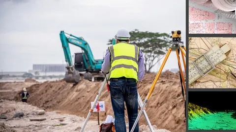
Complete course on fundamentals and applications of surveying, cartography, and their application in GIS - BIM - AI
What you'll learn
Basic principles of surveying
Techniques for measuring distances and angles
Use and handling of surveying instruments
Interpretation of maps and plans
Application of surveying in cadastral systems
Methods for creating and updating cadastral records
Treatment and management of errors in surveying
Trends in integrating surveying with GIS, BIM, and Artificial Intelligence
Requirements
no skills required
Description
Course ObjectiveThe objective of this course is to provide a solid understanding of the fundamental principles of surveying and cadastral systems and their relationship with disciplines associated with land studies. Throughout the course, you will learn about the methods and techniques used in surveying, including measuring distances and angles, using surveying instruments, and interpreting maps and plans. Additionally, we will explore how these concepts are applied in cadastral systems and their connections to land tenure.What Students Will LearnBasic principles of surveying.Techniques for measuring distances and angles.Use and handling of surveying instruments.Interpretation of maps and plans.Application of surveying in cadastral systems.Methods for creating and updating cadastral records.Treatment and management of errors in surveying.Trends in integrating surveying with GIS, BIM, and Artificial Intelligence.Who This Course is ForThis course is ideal for those seeking an introduction to surveying, whether for personal interest or as a foundation for future studies or work in these fields. No prior experience is required, and the course is structured so that the concepts are presented clearly and easy to understand. #AulaGEOThis course serves as a solid foundation for those interested in advancing in the fields of surveying, cartography, and cadastral management. The knowledge gained here will facilitate learning more specific courses within the AulaGEO Academy's offerings, such as GIS (Geographic Information Systems), CIVIL (Civil Engineering Infrastructure Design), and BIM (Building Information Modeling). Additionally, the course supports the relationship between trending disciplines, such as Artificial Intelligence in geospatial information management.Course ContentSection 1: Fundamentals of SurveyingIntroduction and FundamentalsSection 2: Fundamentals of Surveying - PlanimetryPlanimetry - Methods and measuring instrumentsPlanimetry - Surveying techniquesPlanimetry - Error theories in surveyingPlanimetry - Error treatmentPractice Test 1: ReviewSection 3: Fundamentals of Surveying - Tachymetry and AltimetryTachymetry - Tachymetric methods and errorsAltimetry - Altimetric methods and applicationsSection 4: Fundamentals of CartographyHistorical aspects and application of cartographyFundamentals and applications of georeferencingSection 5: Surveying and Cadastral SystemsFundamentals of cadastral systems and their application in surveyingSection 6: Trends in Surveying DisciplineSurveying and integration with GIS, BIM, and Artificial IntelligenceWe hope you enjoy the course.
Overview
Section 1: Fundamentals of Surveying
Lecture 1 Introduction and Fundamentals
Section 2: Fundamentals of Surveying - Planimetry
Lecture 2 Planimetry - Methods and measuring instruments
Lecture 3 Planimetry - Surveying techniques
Lecture 4 Planimetry - Error theories in surveying
Lecture 5 Planimetry - Error treatment
Section 3: Fundamentals of Surveying - Tachymetry and Altimetry
Lecture 6 Tachymetry - Tachymetric methods and errors
Lecture 7 Altimetry - Altimetric methods and applications
Section 4: Fundamentals of Cartography
Lecture 8 Historical aspects and application of cartography
Lecture 9 Fundamentals and applications of georeferencing
Section 5: Surveying and Cadastral Systems
Lecture 10 Fundamentals of cadastral systems and their application in surveying
Section 6: Trends in Surveying Discipline
Lecture 11 Surveying and integration with GIS, BIM, and Artificial Intelligence
Construction Project Managers,Urban Planners,Geographic Information Systems (GIS) Analysts,Surveying Technicians,Civil Engineering Students