


Esri Arcgis Online From Zero: Complete Course
Esri Arcgis Online From Zero: Complete Course
Published 4/2023
MP4 | Video: h264, 1280x720 | Audio: AAC, 44.1 KHz
Language: English | Size: 2.59 GB | Duration: 2h 40m
Published 4/2023
MP4 | Video: h264, 1280x720 | Audio: AAC, 44.1 KHz
Language: English | Size: 2.59 GB | Duration: 2h 40m
Creation of online maps, geoportals, and web applications focused on geography in the cloud.
What you'll learn
Develop the ability to analyze and work with geographic information in ArcGIS Online.
Upload geographic information to the cloud for creating maps, dashboards, and other elements.
Modify the main aspects of vector symbology to develop web maps.
Create a web application based on maps created by the user to be able to share geographic content.
Requirements
Learning projects are included, so no prior knowledge is required. Students will be able to learn everything from scratch.
Description
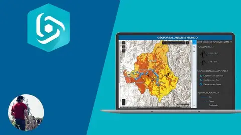
ArcGIS Online is the GIS tool that will become essential for any user of geographic information systems, since geo-portals and territorial data on the web are on the rise and should be the star product of this decade. Therefore, it is necessary to know its characteristics, how to use it, and how to generate information from it.As an objective, the course proposes to review the different areas that the student must manage within the platform, to create a basic web map and transform it into a viewer or geoportal.Likewise, the course will develop the skills to use the platform through the practical exercises that the student must complete as they progress through the readings, so that they become familiar with the web environment and the options it offers.In the course, students will also have the opportunity to learn how to create and edit Story Maps thoroughly. This skill will allow them to present their geographic content efficiently and expressively, which is essential for any mapping project. Through practical exercises and theoretical guidance, students will be able to master the necessary techniques to create attractive and effective Story Maps.Finally, key concepts will be reviewed so that the student can properly handle the files and formats required by the platform.At the end of the course, the student will be able to create various accounts, create maps, share content on the web, and most importantly, generate online maps to share on government and private websites, managing the information used to show to clients or counterparts, and thus having a much smoother flow of communication and data.
Overview
Section 1: Introducción
Lecture 1 Getting Started with ArcGIS Online: An Introduction to Web GIS
Lecture 2 Create an account in ArcGIS Online
Section 2: Getting familiar with the ArcGIS Online platform
Lecture 3 Content tab and basic functionalities in the platform
Lecture 4 Getting familiar with the ArcGIS Online interface.
Lecture 5 Studying measuring tools and markers.
Lecture 6 Functionality of base maps in ArcGIS Online
Section 3: Importing geographic files into ArcGIS Online
Lecture 7 Uploading Shapefile (.SHP) files to the platform
Lecture 8 Uploading Comma-Separated Values (.CSV) files to the platform
Lecture 9 Uploading text (.TXT) and GPS (.GPX) files to the platform
Lecture 10 Uploading Keyhole Markup Language (.KML) files to the platform
Lecture 11 Working with WMS and Living Atlas layers
Lecture 12 Importing tile maps: Google Maps and Mapbox
Section 4: Symbol and Label Analysis I: Polygon Entities
Lecture 13 Configuring unique element symbology in polygons
Lecture 14 Generating symbology by categories or unique elements in polygons
Lecture 15 Configuring symbology by quantity count (size) in polygons
Lecture 16 Creating symbology by quantity count (color) in polygons
Lecture 17 Configuring labels in polygonal entities
Section 5: Symbol and Label Analysis II: Linear Entities
Lecture 18 Configuring Symbols by Unique Elements and Categories in Lines
Lecture 19 Generating Symbols by Counts and Size Quantities in Lines
Lecture 20 Configuring Symbols by Unique Symbol Types
Lecture 21 Configuring Labels in Linear Entities
Section 6: Symbol and Label Analysis III: Point Features
Lecture 22 Configuring location-based symbology and unique symbols for point features
Lecture 23 Generating custom image clusters
Lecture 24 Creating Heat Maps with point features
Lecture 25 Configuring symbology by dates in point features
Lecture 26 Configuring symbology by size in point features
Lecture 27 Configuring labels in point features
Section 7: Advanced work on attribute tables and pop-ups I
Lecture 28 Introduction to ArcGIS Arcade
Lecture 29 Options in attribute tables
Lecture 30 General options in pop-ups
Section 8: Advanced work on attribute tables and pop-ups II
Lecture 31 Custom attribute visualization in pop-ups
Lecture 32 Field description and no attribute information in pop-ups
Lecture 33 Dynamic images and links in pop-ups
Lecture 34 Diagrams in pop-ups
Geographers, Spatial Analysts, GIS Analysts, Forestry Engineers, Natural Resource Engineers, Environmental Engineers, and Cartographers.,University and technical GIS students.,Professionals and technicians focused on territorial information.