

Developing A High Resolution Rusle Model In Qgis

Developing A High Resolution Rusle Model In Qgis
Published 6/2025
MP4 | Video: h264, 1280x720 | Audio: AAC, 44.1 KHz
Language: English | Size: 8.03 GB | Duration: 8h 52m
Published 6/2025
MP4 | Video: h264, 1280x720 | Audio: AAC, 44.1 KHz
Language: English | Size: 8.03 GB | Duration: 8h 52m
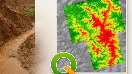
Development of a high-resolution [10 meter] water erosion model in QGIS, with the help of Google Earth Engine and SAGA
What you'll learn
Land use and land cover classification with machine learning in Google Earth Engine
Random forests
Downloading and working with high resolution DEM (ALOS PALSAR)
Developing codes in Google Earth Engine for R factor
Downloading and working with global soil data (from FAO and ESDAC)
Working with SAGA (open source)
Dozens of tools in QGIS
Soil science theory
Erosion modeling theory and practice
RUSLE model
Open source platfroms
Requirements
Basic GIS knowledge
Preferable:Basic QGIS
Preferable:Basic Java Script
Description
Soil erosion remains one of the greatest threats to land productivity, sustainable agriculture, and environmental stability. In this hands-on course, you will learn how to develop a high-resolution (10-meter) RUSLE (Revised Universal Soil Loss Equation) model in QGIS using a powerful combination of SAGA GIS and Google Earth Engine (GEE).This course is designed for GIS professionals, environmental scientists, students, and planners who want to accurately model water-induced soil erosion with modern, open-source tools. You’ll learn how to calculate the five core RUSLE factors—R (rainfall erosivity), K (soil erodibility), LS (slope length and steepness), C (cover management), and P (support practice)—and integrate them into a single spatial erosion map.We’ll use Sentinel-2 imagery, ALOS PALSAR DEM, and field-proven methods to produce reliable, high-resolution results. You'll gain practical skills in:Terrain preprocessing and LS factor derivation in SAGAAccurate land use and land cover classification for the C factor in Google Earth Engine with Random ForestsAssigning soil and conservation values in QGIS and Google Earth ProCombining all layers to generate a final erosion risk mapWe will create our own maps and use global open-source data when it is available. By the end of the course, you’ll be able to create accurate erosion models for any region, using freely available global datasets and open-source GIS software. No need for expensive licenses—just results.This course is ideal for GIS analysts, environmental modelers, students, and professionals working in land degradation, agriculture, watershed management, or conservation.Whether you're focused on a specific region or working on global sustainability assessments, this course gives you the data, tools, and skills to model erosion accurately and effectively.
Overview
Section 1: Introduction
Lecture 1 Introduction to the course(Promo)
Lecture 2 Spatial alignment and parameters
Lecture 3 Data sources
Lecture 4 Softwares to use
Lecture 5 Download QGIS
Lecture 6 Start the QGIS project
Lecture 7 Study area shapefile - reproject into UTM
Section 2: SOIL AND SOIL EROSION. THEORY
Lecture 8 Soil
Lecture 9 Soil erosion
Lecture 10 Soil erosion prevention measures
Lecture 11 Different soil erosion models
Lecture 12 RUSLE model concept
Section 3: RUSLE FACTORS. THEORY
Lecture 13 LS FACTOR
Lecture 14 C FACTOR
Lecture 15 R FACTOR
Lecture 16 P FACTOR
Lecture 17 K FACTOR
Section 4: LS (SLOPE LENGTH). PRACTICE
Lecture 18 How to download ALOS PALSAR DEM
Lecture 19 Saving GeoTIFF in .sdat format in QGIS for SAGA
Lecture 20 Computing LS factor in SAGA
Lecture 21 Mosaic,clip and review LS map
Section 5: C(COVER FACTOR).PRACTICE
Lecture 22 The beginning of the code in GEE
Lecture 23 Computing indices
Lecture 24 Adding elevation and slope bands
Lecture 25 Ground control points collection
Lecture 26 Training and testing data
Lecture 27 K-Fold Cross Validation
Lecture 28 Final classification results and export map
Lecture 29 Assigning C-factor values to each LULC class
Section 6: R(RAINFALL EROSIVITY). PRACTICE
Lecture 30 GloREDa database
Lecture 31 Preparing the GloREDa map for a study area
Lecture 32 R factor in Google Earth Engine
Lecture 33 Resampling R factor from GEE in QGIS
Section 7: P(CONSERVATION PRACTICE). PRACTICE
Lecture 34 Download Google Earth Pro software
Lecture 35 P factor table
Lecture 36 Mapping and discovering conservation practice methods with Google Earth Pro
Lecture 37 Creating slope in % with 10 meter
Lecture 38 Slope reclassify with Raster Calculator
Lecture 39 Rasterize vector of P
Lecture 40 Combining practice raster with cropland-non cropland raster
Lecture 41 Final P-factor map
Section 8: K(SOIL ERODIBILITY).PRACTICE
Lecture 42 Download FAO soil data
Lecture 43 Computing K-factor for dominant soils in Excel
Lecture 44 Vector to raster K-factor
Lecture 45 Global Soil Erodibility map from ESDAC
Section 9: RUSLE MODEL FINAL MAPS IN QGIS
Lecture 46 4 RUSLE maps (models)
Lecture 47 Correcting extreme values and using percentile tool in QGIS
Lecture 48 Map presentation in QGIS from results
Section 10: MISCELLANEOUS
Lecture 49 The model accuracy and how to improve it
Environmental Scientists,Ecologists,Agronomists,Soil scientists,GIS students,Remote sensing students,Farmers,Conservation scientists,Land use planners,Forestry