

Bluff Series : Mastering Arcgis Pro 3

Bluff Series : Mastering Arcgis Pro 3
Published 10/2024
MP4 | Video: h264, 1920x1080 | Audio: AAC, 44.1 KHz
Language: English | Size: 3.75 GB | Duration: 6h 58m
Published 10/2024
MP4 | Video: h264, 1920x1080 | Audio: AAC, 44.1 KHz
Language: English | Size: 3.75 GB | Duration: 6h 58m
Mastering ArcGIS PRO 3, from scratch to a full understanding of GIS software for your GIS career
What you'll learn
Creating a Project and exploring ArcGIS PRO
Navigate and manage spatial data with ArcGIS PRO
Vector data digitization (shp)
Georeferencing raster data
Designing the layout
Requirements
No previous GIS experience required, just simple Microsoft Windows operation required
Description
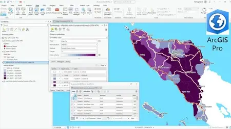
Mastering ArcGIS PRO 3 provides an introduction to the use of ArcGIS PRO version 3, the world's leading GIS software for spatial data analysis and mapping. This course is designed for beginners who want to develop skills in GIS, with no prior experience required.Participants learn basic GIS concepts, such as what is GIS, GIS definitions, GIS data types, map projections. The course covers the ArcCatalog and ArcMap interfaces, including how to navigate data views, layout views, use toolbars, and manage layers. Students are introduced to working with vector and raster data, including importing, visualizing, and performing basic data manipulations. Also how to georeference raster data.Hands-on exercises guide participants in creating and editing shapefiles, applying symbology to meaningfully represent data, and using attribute tables for data analysis, as well as creating thematic maps and choropleths. Participants will gain practical experience in creating map layouts by adding legends, bar scales, and exporting the final product for printing or sharing in JPG or PDF format.At the end of the training, participants will have a thorough understanding of ArcGIS PRO applications (cataloging, symbology, labeling, vector digitizing, raster georeferencing etc.), allowing them to perform simple spatial analysis tasks and create professional-looking maps. This basic knowledge lays the foundation for more advanced GIS techniques and applications.
Overview
Section 1: Course Overview - GIS Explained
Lecture 1 Course Overview
Lecture 2 What is GIS
Lecture 3 GIS Data Types
Lecture 4 Map Projections
Section 2: ArcGIS Pro Exploration
Lecture 5 ArcGIS Pro VS ArcGIS Desktop
Lecture 6 ArcGIS Pro Interface
Lecture 7 Exploring spatial data
Lecture 8 Exporting SHP to KML and geoJSON
Section 3: Managing Spatial Data
Lecture 9 Exploring Contetnt
Lecture 10 Go deeper with attribute table
Lecture 11 Do we need to set Relative path di ArcGIS Pro?
Lecture 12 Arrange Tabs
Lecture 13 View, fill and edit metadata
Section 4: Processing Spatial Data
Lecture 14 Converting GCS into PCS (UTM Zone 47 N)
Lecture 15 Create new fields and update data
Lecture 16 Calculate area with GCS and PCS
Lecture 17 Calculate length with PCS
Section 5: Creating Thematic and Coropleth Map
Lecture 18 Creating a thematic map
Lecture 19 Case Sensitive in thematic maps
Lecture 20 Creating a choropleth map
Lecture 21 Creating a Layer File
Section 6: Designing the Layout
Lecture 22 Designing a layout for a thematic map
Lecture 23 Designing a layout for a choropleth map
Section 7: Digitizing Vector Data
Lecture 24 Creating new polygon feature SHP and digitizing
Lecture 25 Create new polyline feature SHP and digitize
Lecture 26 Create SHP new point features and digitization
Section 8: Georeferencing Data Raster
Lecture 27 Preparing UnGeoreferenced raster
Lecture 28 Georeferencing Raster Data Decimal Degree (DD)
Lecture 29 Georeferencing Raster Data Degree Minutes Second (DMS)
Lecture 30 Georeferencing Raster Data without grid coordinate information
Lecture 31 Georeferencing Raster Data with UTM 47 N
GIS beginners who want to start their GIS career or expand their existing GIS career