

Geomatics & Advance Surveying
Geomatics & Advance Surveying
Published 1/2023
MP4 | Video: h264, 1280x720 | Audio: AAC, 44.1 KHz
Language: English | Size: 51.98 GB | Duration: 40h 42m
Published 1/2023
MP4 | Video: h264, 1280x720 | Audio: AAC, 44.1 KHz
Language: English | Size: 51.98 GB | Duration: 40h 42m
Curve for Road Alignment, Triangulation, Hydrographic & Underground Surveying, Photogrammetry, Remote Sensing, GPS, GIS
What you'll learn
Marking Compound Curve Alignment of Roads
Understanding Concept of Triangulation for Survey of Large Area
Field Operations in Hydrographic Survey and Underground Survey
Photogrammetry and Remote Sensing for Map Creation
Concept of GPS and Application GIS for Map Creation
Requirements
Knowledge of Basic Land Surveying,
Use of Surveying Instruments and Field Procedures
Description
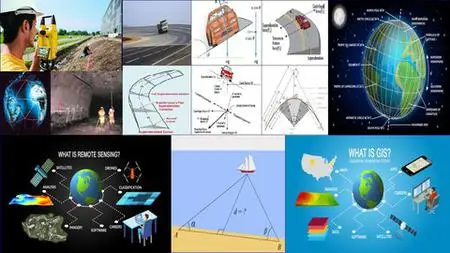
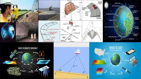
Unit-I: Curves: Classification, degree of curve, elements of circular and compound curves, theory and methods of setting out simple curves, Instrumental method of setting out compound curves.Unit-II: Triangulation: principles, classification of triangulation system, triangulation figures, their choice of station, phase of signals, towers, satellite station, reduction to center, field work, reconnaissance, Inter-visibility, angular measurements. Basenet, extension of Basenet.Unit-III: Hydrographic surveying: necessity, controls, shore line surveys, gauges, sounding equipment’s and procedure of taking soundings, methods of location of sounding, three-point problem in hydrographic surveying, analytical and graphical methods. Underground Surveying: surface alignment, correlation of surface and underground surveys; Weisbach triangle, transferring levels and alignment underground.Unit-IV: Elements of photogrammetry: Basic definitions, terrestrial and aerial photography, scale of vertical photograph, Relief and relief displacements, heights from parallel measurements, flight planning, photographs required.Unit-V:1.Remote sensing: Introduction, definitions, remote sensing systems, advantages over conventional system, energy interaction in the atmosphere, Indian remote sensing satellite series and their characteristics 2. GPS: Global positioning system (GPS) introduction, definitions, GPS receivers, antenna, advantages of GPS.Unit-VI: 1. Geographical Information System: Definition and history, Components of GIS, Data structure and formats, Spatial data models – Raster and vector, Data base design- editing and topology creation in GIS, Linkage between spatial and non-spatial data, Introduction to QGIS software. 2. GIS application: Application in Geological Investigations, water resources management, environmental studies, EIA based studies, Land use planning, soil studies and transportation planning.
Overview
Section 1: Unit-I Curves in Road Alignment
Lecture 1 Types of Curve
Lecture 2 Elements of Simple Curve
Lecture 3 Locating Curve by Offset from Long chord and Tangent
Lecture 4 Problem on Locating Curve by Offset from Long chord and Tangent
Lecture 5 Locating Curve by Offset from Chord produced
Lecture 6 Problem on Locating Curve by Offset from Chord produced
Lecture 7 Locating Curve by Deflection Angle Method
Lecture 8 Problem on Locating Curve by Deflection Angle Method
Lecture 9 Locating Curve by Two Theodolite and Tachometric Method
Lecture 10 Introduction to Transition Curve
Lecture 11 Elements of Transition Curve
Lecture 12 Problems on Transition Curve
Lecture 13 Design of Compound Curve
Section 2: Unit-II Triangulation
Lecture 14 Triangulation Basic
Lecture 15 Classification of Triangulation System
Lecture 16 Triangulation Figure
Lecture 17 Triangulation Process
Lecture 18 Intervisibility of Stations Problem
Lecture 19 Intervisibility of Stations Problem-2
Lecture 20 Extension to base net
Lecture 21 Triangulation Calculations
Lecture 22 Triangulation Problems
Section 3: Unit-III Hydrographic Surveying
Lecture 23 Hydrographic Surveying- Introduction
Lecture 24 Sounding Equipment
Lecture 25 Locating Sounding Points -I
Lecture 26 Locating Sounding Points -II
Lecture 27 Three Point Problem Graphical Solution
Lecture 28 Three Point Problem – Analytical Solution
Lecture 29 Underground Surveying - Mine Surveying
Lecture 30 Transferring Level Underground
Section 4: Unit-IV Photogrammetry
Lecture 31 Photogrammetric Surveying – Concepts & Definition
Lecture 32 Scale of Vertical Photograph
Lecture 33 Relief Displacement
Lecture 34 Flight Planning
Lecture 35 No. of Photographs
Section 5: Unit-V Remote Sensing & GPS
Lecture 36 Introduction to Remote Sensing
Lecture 37 Types of Remote Sensing System
Lecture 38 Stages in Remote Sensing
Lecture 39 Electromagnetic Spectrum
Lecture 40 Application of Remote Sensing
Lecture 41 Global Positioning System
Lecture 42 Application of GPS
Lecture 43 Indian Remote Sensing System
Section 6: Unit-VI Geographical Information System
Lecture 44 Introduction to GIS
Lecture 45 Function and Objectives of GIS
Lecture 46 GIS Capabilities
Lecture 47 Application of GIS
Lecture 48 Working with GIS
Section 7: Unit-VII Tachometric Surveying
Lecture 49 Introduction to Tachometry
Lecture 50 Tachometry Formula Derivation
Lecture 51 Problems on Tachometry -B
Lecture 52 Subtense Method
Lecture 53 Tangential Method of Tachometry
Lecture 54 Other Instruments for Tachometry
Civil Engineering Freshers,,Civil Engg Diploma Student,,ITI Surveyor,,Draughtsman Civil,,Building Site Supervisor