

Civil 3D Level 4/4 - For Civil Works And Land Surveying
Civil 3D Level 4/4 - For Civil Works And Land Surveying
Last updated 2/2021
MP4 | Video: h264, 1280x720 | Audio: AAC, 44.1 KHz
Language: English | Size: 6.80 GB | Duration: 10h 52m
Last updated 2/2021
MP4 | Video: h264, 1280x720 | Audio: AAC, 44.1 KHz
Language: English | Size: 6.80 GB | Duration: 10h 52m
Learn to create basic linear designs and works with the Autocad Civil3D software applied to Surveying and Civil Works
What you'll learn
Participate in the design of roads and civil and topographic projects.
When conducting a topographic survey in the field, you can import these land points to Civil3D and save a lot of time in drawing.
Create land surfaces in 2 and 3 dimensions and generate calculations such as area, volume and earth movement
Build horizontal and vertical alignments that allow the design of a linear work such as roads, canals, bridges, railways, high voltage lines, among others.
Prepare professional plans to present works both in plan and in profile.
Requirements
A computer with basic requirements of Hard Disk, RAM (minimum 2GB) and Intel Processor, AMD
Autocad Civil 3D software any version
Very basic knowledge of Surveying, Civil or related
Description
Disclaimer:We have selected this course to offer it in English for its high pedagogical quality and user acceptance.The version of the software used is in Spanish, but the whole explanation of the instructor is narrated in English.–––––––––––––––––––- #AulaGEOThis is the fourth of a set of 4 courses called "Autocad Civil3D for Surveying and Civil Works" that will allow you to learn how to handle this fabulous Autodesk software and apply it to different projects and construction sites. Become an expert in the software and you can generate earthworks, calculate materials and construction prices and create great designs of roads, bridges, sewerage among others.This set of courses has been the product of hours of dedication, work and effort, compiling the most important data on the subject of Civil and Topographic Engineering, summarizing large amounts of theory and making them practical, so that you can learn in an easy and easy way. Fast with short but specific classes for each topic and practice with all the (real) data and examples we provide here.If you want to start managing this software, participating in this course will save you weeks of work by investigating on your own what we have already investigated, doing the tests we have done, and making the mistakes we have already made.Let us introduce you to this world of Autocad Civil3D, which is a powerful tool to reduce large amounts of time designing and calculating and facilitating your work in the professional field.Who is it for?This course is aimed at technicians, technologists and professionals with knowledge in Surveying, civil or related works, who want to start in the world of road design, linear works, earthworks and construction or those who want to strengthen their skills in the management of This powerful tool.CONTENT OF THE MIDDLE COURSE (4/4)PLAN SETTINGS- Template building.- Automatic generation of floor plans.- Automatic generation of planes in profile.- Automatic generation of floor plans-profile.- Automatic generation of cross section planes.EXPLANATIONS (GRADING)- Definition and configuration.- Sloping and transition of slopes.- Volume balance.- Surface generation.INTERSECTIONS- Cross intersection construction.- Adding branches- Linear work design from intersection- Construction of a roundabout or roundabout.PLOT CONSTRUCTION- Calculation of areas and perimeters- Alignment- Topology- Locations- Englobes and desenglobeCALCULATION OF SURFACE ESCORRENTY- Surface design- Basin analysis- Drains and hydrological sub-basinsDRAWING OF SANITARY NETWORKS AND PIPES- Object projection- Profiles- Material calculations
Overview
Section 1: Labeling plans
Lecture 1 S1 study material
Lecture 2 Create template from scratch
Lecture 3 Set up drawing on paper presentation
Lecture 4 Configure template for layout plans
Lecture 5 Create minutes or display frames for layout
Lecture 6 Creation of plans Floor - Profile
Lecture 7 Creation of plans Section
Section 2: Grading
Lecture 8 S2 study material
Lecture 9 Characteristic lines for esplanaciones
Lecture 10 Creation of an esplanade by distance I
Lecture 11 Creation of an esplanade by distance II
Lecture 12 Creation of an esplanade by distance III
Lecture 13 Creation of a surface area
Lecture 14 Creation of an esplanade by elevations and transitions
Section 3: Intersection and Roundabouts
Lecture 15 S3 study material
Lecture 16 Create intersections between two or more alignments
Lecture 17 Create intersections with segregated lanes
Lecture 18 Create intersections using existing geometry
Lecture 19 Horizontal geometric intersection editing
Lecture 20 Vertical geometric edition of intersections
Lecture 21 Creation and edition of a linear work at an intersection
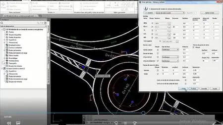
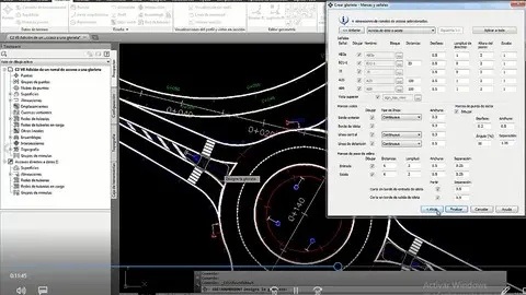
Lecture 22 Creation of a roundabout
Lecture 23 Adding branches, segregated lanes and editions
Section 4: Adding branches, segregated lanes and editions
Lecture 24 S4 study material
Lecture 25 Creation of plots from objects
Lecture 26 Parcels subdivisions
Lecture 27 Properties of plots and alignments
Lecture 28 Parcel Editing
Lecture 29 Creation of servitude, tables and reports
Section 5: Pipes and Networks
Lecture 30 S5 study material
Lecture 31 Pipe network creation from objects
Lecture 32 Creation of pipe network by composition tools
Lecture 33 Add parts to a pipe network
Lecture 34 Change pipe network properties
Lecture 35 Pipe network display in profile and labels
Lecture 36 Pipe network editing in section and style view
Lecture 37 Network section view of pipes, tables and reports
Section 6: Watersheds
Lecture 38 S6 study material
Lecture 39 Collection basin analysis
Lecture 40 Water drop and watershed
Lecture 41 Shed Basin Object
Lecture 42 Extract objects from catchment basins and legend
Lecture 43 Creation of surface masks
Lecture 44 Catchment basins
Section 7: Materials and quantities of work
Lecture 45 S7 study material
Lecture 46 Prepare surface for material calculation
Lecture 47 Create cubing criteria and bill of materials
Lecture 48 Modify and add cubing criteria and materials
Lecture 49 Create and edit section views and tables
Lecture 50 Creation of mass diagram
This course is built for anyone who wants to learn how to handle the software.,Technicians, Technologists or Professionals in Surveying, Civil or related who want to improve their productivity and skill with the software.,Anyone who wants to learn to make designs of linear works and topography projects.