


Beginners guide to OpenRoads - civil works desgin
Beginners guide to OpenRoads - civil works desgin
Published 04/2022
MP4 | Video: h264, 1280x720 | Audio: AAC, 44.1 KHz, 2 Ch
Genre: eLearning | Language: English + srt | Duration: 45 lectures (2h 19m) | Size: 1.36 GB
Published 04/2022
MP4 | Video: h264, 1280x720 | Audio: AAC, 44.1 KHz, 2 Ch
Genre: eLearning | Language: English + srt | Duration: 45 lectures (2h 19m) | Size: 1.36 GB
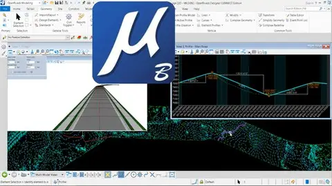
Use Bentley Systems OpenRoads tool to Microstation civil design
What you'll learn
Open Roads dsign
Bentley Open Roads
Linear design
Land, surface terrain
Requirements
No recquirements
Description
GETTING STARTED
Lecture 1: Bentley Open Roads vs Autodesk Civil 3D
Lecture 2: Getting Started
Lecture 3: Keyboard Shortcuts
HORIZONTAL GEOMETRY
Lecture 4: Create Horizontal Geometry from Scratch
Lecture 5: Read existing Horizontal Geometry
Lecture 6: Edit existing Horizontal Geometry
Lecture 7: Modify existing Horizontal Geometry
Lecture 8: Annotate HorizontalGeometry
Lecture 9: Vertical Geometry View and Horizontal Geometry Report Generation
VERTICAL GEOMETRY
Lecture 10: Create Vertical Geometry
Lecture 11: Edit Vertical Geometry using Table Editor
Lecture 12: Edit Vertical Geometry using Dynamic Input (Right Click)
Lecture 13: Vertical Geometry Report Generation
SUPER ELEVATION
Lecture 14: Create Super elevation sections
Lecture 15: Create Super elevation by road template
Lecture 16: Super elevation rules and calculations
Lecture 17: Super elevation view and edit
Lecture 18: Super elevation report and CSV export
Lecture 19: Super elevation table editor
CORRIDORS
Lecture 20: Creating Corridor
Lecture 21: 3D View of Corridor
Lecture 22: Template Drop
Lecture 23: Cross Section View
Lecture 24: Assign super elevation to corridor
TERRAIN
Lecture 25: Read existing Terrain
Lecture 26: Terrain Features
Lecture 27: Editing Major and Minor Contours
Lecture 28: Reference Terrain to 2D File
Lecture 29: Editing Reference Terrain
Lecture 30: Use of Element Templates
Lecture 31: 2D vs 3D Terrain View
Lecture 32: Label Terrain Contours
Lecture 33: Label Terrain Spot
Lecture 34: Analyze Points
CIVIL CELLS
Lecture 35: Civil Cell Placement
Lecture 36: 3D View of Civil Cell
Lecture 37: Civil Cell Alternatives View
Lecture 38: Edit Civil Cell Style
Lecture 39: Edit Civil Cell Template
Lecture 40: Edit Civil Cell Parameters
Lecture 41: Edit Applied Surface Template
Lecture 42: Parametric Constraints
Lecture 43: Civil Cell Exercise
Lecture 44: A Quick Virtual Tour
Who this course is for
Civil engineers
Civil works designers
CAD designers
AutoCAD and Microstation users