

Basic Land Surveying

Basic Land Surveying
Published 8/2022
MP4 | Video: h264, 1280x720 | Audio: AAC, 44.1 KHz
Language: English | Size: 48.48 GB | Duration: 37h 10m
Published 8/2022
MP4 | Video: h264, 1280x720 | Audio: AAC, 44.1 KHz
Language: English | Size: 48.48 GB | Duration: 37h 10m
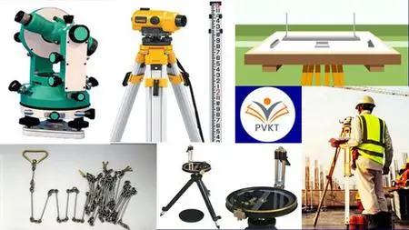
Basic of Geomatics, Chain Survey, Compass Survey, Levelling Survey, Theodolite Survey, Plane Table Survey
What you'll learn
1] Basics of Land Surveying
2] Chain Surveying
3] Compass Surveying
4] Theodolite Surveying
5] Levelling Surveying
6] Plane Table Surveying
Requirements
Be able to know basic of units of measurement
Be able to know basic of Engineering Drawing
Minimum Educational Qualification - SSC 10th Pass
Description
Learning Objectives of this Course are:1. To learn about the term surveying, various instruments and possible error.2. To learn Linear Measurement methods and way of conduction.3. To learn about the measurement at elevation and of Directions , contour development process.4. To understand and learn performing Plane table surveying.Course Outcomes:At the end of the course the student will be able to:1. Define principles of Surveying, Remote Sensing and Geomatics.2. Describe different instruments, tools, applications and techniques to determine the positions on the surface ofthe earth, change detection.3. To perform Liner measurement methods of surveying.4. Differentiate the techniques for setting out alignments, curves, other layouts, modern survey systems etc.5. To perform survey at elevation and conduct Plane Table survey.Brief Course Content:Unit-I – Basics of Geomatics / Surveying - Unit-II - Linear Measurement (Chain Surveying)Unit-III - Measurement of Elevations (Levelling Surveying)Unit-IV - Measurement of Direction (Compass Surveying)Unit-V – Traversing (Theodolite Surveying)Unit-VI - Plane Table SurveyingReference Books Recommended:1. D. Clarke: Plane and Geodatic Surveying, Volume I & II2. T.P. Kanetkar & Kulkarni: Surveying & Levelling, Part I & II.3. B.C. Punmia : Surveying I & II.4. N.N. Basak : Surveying & Levelling.Top 5 Advantages of Land Surveying:Land Survey helps us to prepare for construction in the similar way you consult interior desiginer and structural engineers on building design you need to consult land survey engineer to know the potential of the land. Land surveyor can help you begin work without any issue.It is not possible to measure the plot of new land without the help of Land Survey as it might leads to inappropriate land measurements. So a proper land survey is necessary as it clearly states property boundaries which can further help the management teams for appropriate construction plan and will save you from property line trouble and disputes with neighbor.Without proper land survey the value of property can be over or under valued so there is necessity for accurate land survey. If you want to understand fully your worth and purchase based on location, landscape and hardscape you will need to hire proper land survey engineer.It is necessary to understand the topographical details before purchasing the property. Detection of soil and structural issues, determination of flood prone area and get accurate representation of plot it is necessary for engineers to conduct land survey. A proper land survey will help you protect from disaster and push back and halt construction.To separate business owner from residential and commercial purposes landowners may want to begin with plot parceling. For proper division of property into pre-determined section which can be priced and handed over correctly without any inaccuracies there is a need for proper land survey.
Overview
Section 1: Unit-I – Basics of Geomatics / Surveying
Lecture 1 Need Concept & Objective
Lecture 2 Classification and Principal of Surveying
Lecture 3 Units of Measurement
Lecture 4 Accuracy and Errors
Lecture 5 Eliminations of Errors
Lecture 6 Maps and Scales
Lecture 7 Map Projection, Numbering and Elements
Section 2: Unit-II - Linear Measurement (Chain Surveying)
Lecture 8 Introduction to Linear Measurement
Lecture 9 Instruments for Chain Surveying
Lecture 10 Errors in Linear Measurement
Lecture 11 Chain and Tape Corrections
Lecture 12 Obstacles in Chaining
Lecture 13 Chaining on Sloping Ground
Lecture 14 Setting Perpendicular Offsets
Lecture 15 Area by Chain Surveying
Lecture 16 Linear Measurement by Optical Methods
Section 3: Unit-III - Measurement of Elevations (Levelling Surveying)
Lecture 17 Introduction and Concepts of Levelling
Lecture 18 Types of Bench Marks
Lecture 19 Types of Levels
Lecture 20 Use of Levelling Instrument
Lecture 21 Height of Instrument Method
Lecture 22 Rise and Fall Method
Lecture 23 Profile Levelling and Cross Sectioning
Lecture 24 Curvature & Refraction
Lecture 25 Contour Surveying
Lecture 26 Method of Contouring
Section 4: Unit-IV - Measurement of Direction (Compass Surveying)
Lecture 27 Measurement of Bearing
Lecture 28 Types of Bearing
Lecture 29 Magnetic Declination
Lecture 30 Local Attraction
Lecture 31 Included Angle in Traverse
Lecture 32 Compass Traversing
Lecture 33 Errors in Compass Surveying
Section 5: Unit-V – Traversing (Theodolite Surveying)
Lecture 34 Introduction to Theodolite
Lecture 35 Angle Measurement using Theodolite
Lecture 36 Taking Reading using Vernier Theodolite
Lecture 37 Methods of Theodolite Traversing
Lecture 38 Problems on Latitude & Departure
Lecture 39 Gale’s Traverse Table
Section 6: Unit-VI - Plane Table Surveying
Lecture 40 Instruments for Plane Table Surveying
Lecture 41 Procedure for Plane Table Surveying
Lecture 42 Advantages and Limitations of PTS
Lecture 43 Method of Orientation of PTS
Lecture 44 Three Point Problem in Plane Table Surveying
Lecture 45 Area of Irregular Figure
Lecture 46 Introduction to Total Station
ITI Draughtsman civil / Architectural Draftsman / Building construction / Mason / Surveying Students,Polytechnic civil engineering students, construction site supervisors, civil engineering assistant,UG Students of Civil Engineering, Building site supervisor, Practicing Civil Engineers