

Arcgis Skills For: Tasks, Projects & Freelance Work
Arcgis Skills For: Tasks, Projects & Freelance Work
Last updated 6/2022
MP4 | Video: h264, 1280x720 | Audio: AAC, 44.1 KHz
Language: English | Size: 3.96 GB | Duration: 6h 21m
Last updated 6/2022
MP4 | Video: h264, 1280x720 | Audio: AAC, 44.1 KHz
Language: English | Size: 3.96 GB | Duration: 6h 21m
ArcGIS Projects & Tasks
What you'll learn
ArcGIS, GIS
Digital Elevation Model making
Contour Map
Choropleth Map
Soil Map
Flow Map
Watershed delineation
Stream Order
Map Digitizing
ArcGIS Tasks
Road length calculation
Rainfall deviation Map
Requirements
Have a Computer
ArcGIS Desktop 10.3 or higher
Basic Knowledge of ArcGIS Interface
Description
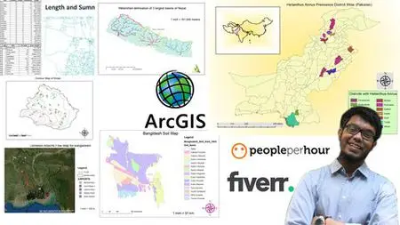
This course is for those who have learned the basics of ArcGIS and want to enhance their skills further. If you are a complete beginner don’t worry, I have another course called: “ArcGIS: From beginner to pro” which covers all the basics you need to start your work with ArcGIS, and that course complements this course perfectly.List of Sections and Lessons:Introduction1. IntroductionConvert Coordinate System of shapefile:1. How to convert the coordinate system2. Learning OutcomeDEM & Contour Project:1. Make a DEM & Contour of Nepal2. Contour Mapmaking3. Quick DEM resources4. Making Contour Map Method-25. Comparison of the two methods6. Convert contour shapefile to AutoCAD file7. Convert AutoCAD file with labels8. Learning OutcomeChoropleth Mapping Project1. How to do choropleth mapping2. Replicating a freelance market gig3. Learning OutcomeTasks:1. Join Excel data to attribute table2. Making a population dot density map3. Calculate coordinates of schools in Sonargaon4. Add date, time, and coordinate system to map5. Copying shapefile without attribute6. Copying shapefile without attribute part-27. Raster analysis problem and solutionRainfall Pie Chart Map:1. Downloading data2. Adding CSV file to attribute table3. Precipitation pie chart mappingWatershed delineation Project:1. Project Introduction2. Downloading data3. Watershed delineation part-14. Watershed delineation part-25. Map Making6. Some common presentation methods7. Extra SupportFlow Map Project:1. Project overview2. Flow map part-13. Flow map part-24. Final MapTasks & Tips:1. Saving Coordinate system to favorites2. Benefit of saving coordinate system3. Interlocking shapefile creating tip4. Change decimal places displayed in the attribute table5. Add multiple labels6. Add units to labelsDigitizing Project:1. Overview of Project2. Georeferencing3. Creating features and attribute fields4. Polygon making5. Roadmaking6. Point making7. Final Mapping for deliveryRoad calculation Project:1. Overview of Project2. Changing the coordinate system3. Calculating the length of roads4. Making individual type road shapefile5. Checking results using statisticsRainfall deviation Map:1. Overview2. Rainfall deviation part-13. Rainfall deviation part-24. Rainfall deviation part-3Soil Map Preparation:1. Overview2. Soil Map part-13. Soil Map part-24. Soil Map part-35. Soil Map part-4Stream Order:1. Overview2. Stream order part-13. Stream order part-24. Stream order part-3
Overview
Section 1: Introduction
Lecture 1 Introduction
Section 2: Convert Coordinate system of a Shapefile
Lecture 2 How to convert Coordinate system of a shapefile
Lecture 3 Learning Outcome
Section 3: DEM & Contour Project
Lecture 4 Make a DEM and Contour of Nepal
Lecture 5 Contour Map Making
Lecture 6 Quick DEM Resources
Lecture 7 Making Contour Map Method-2
Lecture 8 Comparison of the two method results
Lecture 9 Convert Contour Shapefile to AutoCAD file
Lecture 10 Convert to AutoCAD file with labels
Lecture 11 Learning Outcome
Section 4: Choropleth Mapping Project
Lecture 12 How to do Choropleth mapping
Lecture 13 Replicating a freelance market gig
Lecture 14 Learning outcome
Section 5: Tasks
Lecture 15 Join Excel data to Attribute Table
Lecture 16 making a population dot density map
Lecture 17 Calculate coordinates of schools in Sonargaon
Lecture 18 Add date, time and coordinate system name using dynamic text
Lecture 19 Copying shapefile without attribute
Lecture 20 Copying shapefile without attribute part-2
Lecture 21 Raster analysis problem and solution
Section 6: Precipitation Pie chart map Project
Lecture 22 Downloading data
Lecture 23 Adding CSV file to attributes Table
Lecture 24 Precipitation pie chart Mapping
Section 7: Watershed delineation Project of the 3 largest basins of a Country
Lecture 25 Project Introduction
Lecture 26 Downloading necessary data and assigning coordinate system to it
Lecture 27 Watershed delineation Part-1
Lecture 28 Watershed delineation Part-2
Lecture 29 Map Making
Lecture 30 some common presentation methods
Lecture 31 Extra support
Section 8: Flow Map Project
Lecture 32 Project over view
Lecture 33 Flow Map Part-1
Lecture 34 Flow Map Part-2
Lecture 35 Final Map
Section 9: Tasks & Tips
Lecture 36 Saving coordinate system to favorites for easier work
Lecture 37 Benefit of saving coordinate system to favorites
Lecture 38 Interlocking shapefile creating tip
Lecture 39 change decimal places display in attribute table
Lecture 40 Add Multiple labels
Lecture 41 Add units to labels
Section 10: Digitizing Project
Lecture 42 Overview of Project
Lecture 43 Georefrencing
Lecture 44 Creating features and attribute fields
Lecture 45 polygon making
Lecture 46 road making
Lecture 47 Point making
Lecture 48 Final mapping for delivery
Section 11: Road calculation Project
Lecture 49 Overview of Project
Lecture 50 Changing the coordinate system for length calculation
Lecture 51 Calculating Length of roads
Lecture 52 making individual type road shape files
Lecture 53 Checking the results using statistics options
Section 12: Rainfall Deviation Map
Lecture 54 Overview
Lecture 55 Rainfall Deviation part-1
Lecture 56 Rainfall Deviation part-2
Lecture 57 Rainfall Deviation part-3
Section 13: Soil Map Preparation
Lecture 58 Overview
Lecture 59 Soil Map Part-1
Lecture 60 Soil Map Part-2
Lecture 61 Soil Map Part-3
Lecture 62 Soil Map Part-4
Section 14: Stream Order
Lecture 63 Overview
Lecture 64 Stream order part-1
Lecture 65 Stream order part-2
Lecture 66 Stream order part-3
Section 15: Bonus
Lecture 67 Bonus Lecture
Anyone who wants to learn