

Advanced UAV Photogrammetry - Part 2 - Pix4D Mapper - 2019

Advanced UAV Photogrammetry - Part 2 - Pix4D Mapper - 2019
Genre: eLearning | MP4 | Video: h264, 1280x720 | Audio: aac, 48000 Hz
Language: English | Size: 1.89 GB | Duration: 2.5 hours
Genre: eLearning | MP4 | Video: h264, 1280x720 | Audio: aac, 48000 Hz
Language: English | Size: 1.89 GB | Duration: 2.5 hours
Pix4D Mapper data procesing
What you'll learn
Pix4D Mapper data procesing
Optimal PC specification for Pix4D Mapper
Preparing your PC to work with Pix4D Mapper
Optimal processing options for your project
Various outputs generation
Point cloud clean-up and classification
Improving Pix4D Mapper’s outputs
Volume calculations in Pix4D Mapper
Project splitting and merging
Pro Tips!
Requirements
This course is for beginners and advanced drone users. I will show everything from the beginning. Advanced users will certainly can improve their skills
Decent PC to process UAV data
Pix4D Mapper (trial or full version)
Basic computer skills
Description
Master UAV Photogrammetry data processing in Pix4D Mapper with the most complete course on the market!
Achieve the most accurate results with UAV Photogrammetry on real-world examples.
This course covers:
Creating a new project,
Choosing optimal processing options,
Accurate georeferencing using GCPs,
GCP marking,
Ellipsoid error correction
Quality assessment,
Project splitting and merging,
Tips and tricks
and more!
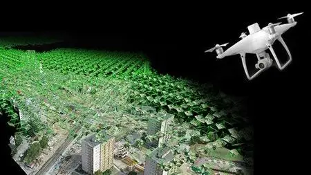
I will show you how to create: point cloud, 3D textured mesh, orthomosaic, DSM, DTM and contour lines using real-world examples from my everyday jobs.
This course is second part of 4 course series “Advanced UAV photogrammetry”. It is for beginner and advanced users.
If I had to describe this course series in one sentence, I would say: “This is exactly the course I wish I had when I first started surveying with UAV Photogrammetry".
Pix4D Mapper Tutorial
Who this course is for:
Little or more experienced drone operators
Land surveyors who want to learn UAV photogrammetry