AEC with Python and QGIS

AEC with Python and QGIS
Duration: 2h 18m | .MP4 1280x720, 30 fps(r) | AAC, 48000 Hz, 2ch | 470 MB
Genre: eLearning | Language: English
Duration: 2h 18m | .MP4 1280x720, 30 fps(r) | AAC, 48000 Hz, 2ch | 470 MB
Genre: eLearning | Language: English
QGIS is an open-source tool for quickly visualizing and analyzing geospatial data for architecture, engineering, and construction (AEC). One way to make QGIS even more versatile and efficient is to add the power of Python. In this course, CAD and GIS consultant Gordon Luckett shows how to use Python scripting to automate and augment the QGIS toolset. It starts with an overview of Python programming basics, including creating and saving basic scripts. Then Gordon shows how to automate common QGIS tasks, such as opening, closing, and saving projects; adding new layers and layer definitions; and creating and managing geometry. Gordon also shows how to automate the import of AutoCAD data such as DWG and DXF files into QGIS projects, and closes the course with a hands-on demo of the QGIS plugin creation process, leveraging the Plugin Builder, QT Designer interface builder, and Python code.
Topics include:
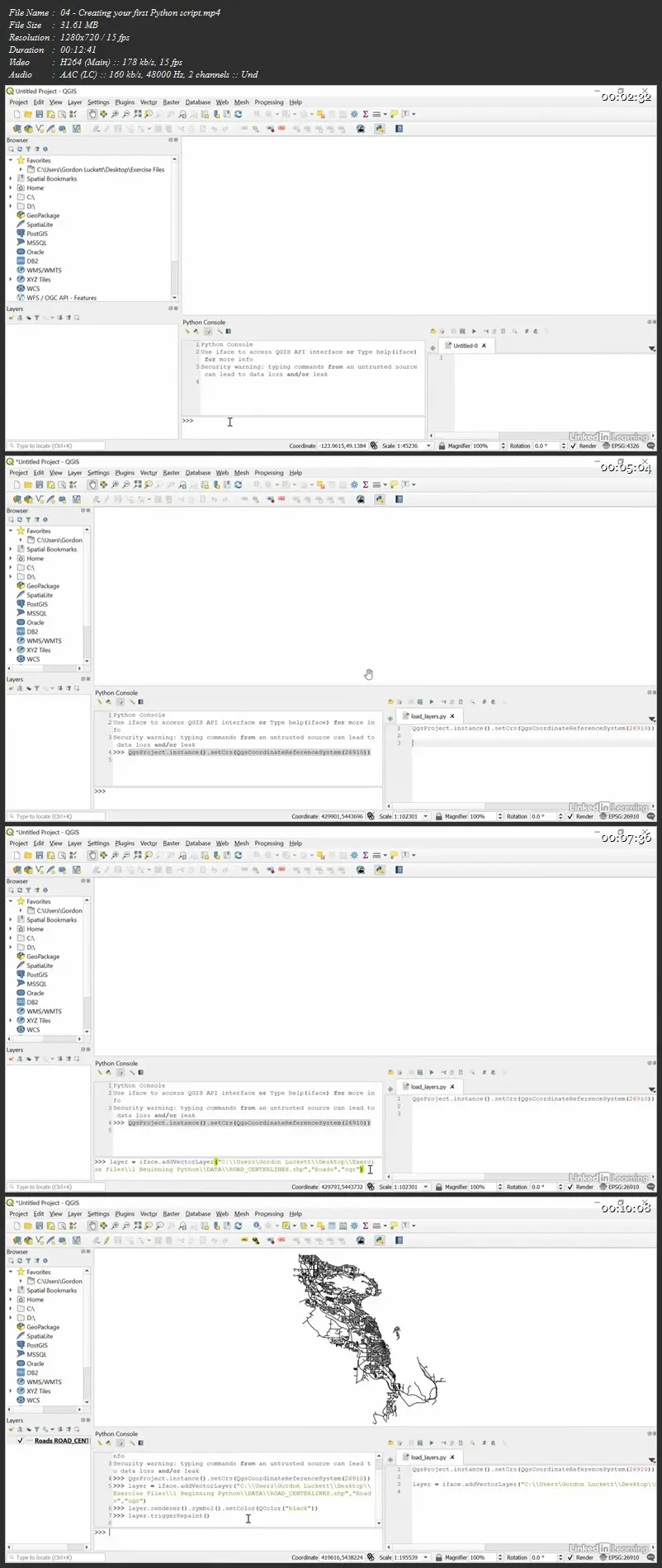
Creating your first Python script
Saving scripts
Managing QGIS projects and layers programmatically
Exporting geometry
Drawing new geometry
Importing DWG and DXF files
Creating plugins
AEC with Python and QGIS