Attention❗ To save your time, in order to download anything on this site, you must be registered 👉 HERE. If you do not have a registration yet, it is better to do it right away. ✌
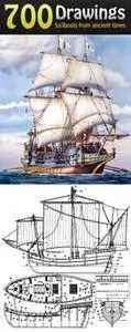
Sailboats Drawings from Ancient Times Collection format TIF & JPEG | over 700 drawings | ~5000x3000 | 2.99 Gb
This large collection of drawings and images of sailboats from antiquity to modern times are presented. The drawings are detailed enough, given in high resolution and can be used to create ship models, as well as study the history of construction of sailboats.
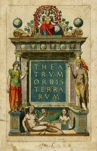
World Atlas Ortelius Theatrum Orbis Terrarum format TIF | 7000x5000 | 54 high-res scans | 5.23 Gb
Ortelius compiled the world's first geographic atlas, consisting of 53 large-format maps with detailed explanatory geographical texts, which was published in the city of Atveres on May 20, 1570. The Atlas was named Theatrum Orbis Terrarum and reflected the state of geographical knowledge on that time. This atlas was repeatedly supplemented and republished and was very popular among navigators of the late 16th - early 17th centuries. Along with the Mercator Atlas, he also played an important role in the development of cartography.
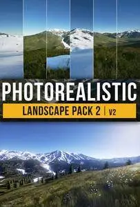
This set "Photoreal Landscape Pack 2" includes highly detailed 64 km2 (8x8 km). This collection comes with photo-realistic landscapes, completely ready for use to create your scenes. Include 5 different landscapes and 3 seasons landscape material.
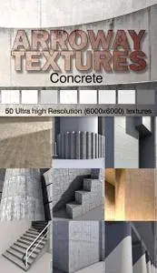
Arroway Concrete Textures (Optimal Version) format JPEG | from 4000х4000 to 6000х6000 | 1.6 Gb
Arroway Concrete volume one contains 50 multi-layered high-res textures, each consisting of diffuse, bump and specularity map. The collection covers textures of the following categories: bricks & tiles, floor surfaces, panel formed surfaces, wall surfaces, misc. All textures seamless.