


Transdat v12.05 Bilingual
Transdat v12.05 Bilingual | 3MB
TRANSDAT Geosoftware executes coordinate transformations and geodetic datum shifts between lots of coordinate and reference systems of Germany, Europe, America, Australia and world wide in high quality and with high performance:
1. The German Coordinate and Reference Systems of the old and new Federal Countries including the 40 Prussian Soldner Land Registers and Soldner Berlin and Munic.
2. The current and many historical Coordinate and Reference Systems of all States of the European Union (EU) including the eastern extensions and other European Systems.
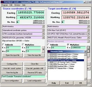
3. The US- and Canadian State Plane Coordinate Systems (SPCS) on NAD27 and NAD83 and other Coordinate and Reference Systems of the North American Continent.
4. The Coordinate and Reference Systems of the Australian Continent and important systems of other continents.
5. All over the world with NTv2 grid files supported coordinate transformations.
6. All world-wide uniform Coordinate and Reference Systems.
You find a complete list of the coordinate and reference systems supported by the program in the internet or after downloading of the programs free test version. The NTv2 standard with national grid files is supported. Additional to the predefined world-wide and state-specific systems also your own coordinate systems and geodetic reference systems can be defined with Helmert (Bursa / Wolf, ISO19111) or Molodenski parameters. Calculations can be performed with coordinates entered directly, loaded from files in various formats (Text, dBase, ArcShape and ArcGenerate) or passed through batch processing. ArcShape files can be viewed with the program intern Shape Viewer. A programmable GPS interface makes possible to read coordinates from a low cost GPS antenna into a notebook. The program can be run on network, where clients are installed automaticly. The program has user-selectable German or English language interface and comes with extensive bi-language online help.
Download