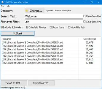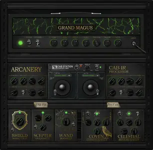
ToneLib GrandMagus v1.0.0 | 22.9 Mb
TL GrandMagus is a full-featured amp suite that will imbue your guitar tone with a full spectrum of arcane wizardry. From transparent Clean, through crispy British-style Crunch to fire-blast High Gain - choose any spell to cast.