

PCI Geomatica 2012 SP1 32bit & 64bit
PCI Geomatica 2012 SP1 32bit & 64bit | 211.3 mb & 267.1 mb
PCI Geomatics is the developer of Geomatica - a complete and integrated desktop software that features tools for remote sensing, digital photogrammetry, geospatial analysis, map production, mosaicking and more.
About PCI Geomatics
Founded in 1982, PCI Geomatics began developing geospatial software solutions when the industry was very young and the potential of geospatial information was just beginning to be realized.
Since then, we have led the way with technological innovations through a pioneering spirit, strong technology partnerships, and active geomatics community involvement.
As a founding member of the Open Geospatial Consortium (OGC®), we understand the industry, it’s needs, and continue to develop leading-edge solutions that our geospatial professionals require to excel in their respective fields, and we continue to invest heavily in Research and Development to ensure that our customers are always on the leading edge of the technology curve.
Overview
With 1,000s of installations in over 135 countries, Geomatica has established itself as the world leader in enabling geospatial professionals to solve problems quickly and effectively. Geomatica 2012 improves on this legacy with advanced automation, performance, and more:
- 64-bit Power
Geomatica 2012 has been rebuilt from the ground up using 64-bit architecture. This removes memory constraints, alleviates bottlenecks, and allows your system to grow with the industry; enabling you do work with increasingly large datasets for years to come.
- Automation
Geomatica 2012 delivers intelligent automatic mosaicking that includes automatic detection and removal of image brightness variations, radiometric color balancing between images, and automatic cutline determination to minimize visibility of seams in the mosaic.
The streamlined Manual Mosaicking workflow allows users to manually visualize their mosaic prior to actually running the process.
- PCI Modeler
PCI Modeler provides an interactive methodology for the development of both simple and complex workflows. PCI Modeler provides access to a number of standard operations such as data import and export, as well as most EASI/PACE processing programs.
The batching capabilities of PCI Modeler enables import files, export files, and parameter variations through multiple runs of a model making modeler a much more powerful visual scripting environment.
- Advanced Synthetic Aperture Radar (SAR) Analysis
Geomatica 2012 also adds SAR Coherent Change Detection giving users the ability to detect changes using remote sensing.
SAR is a particularly attractive tool for this application, because of its ability to collect fine resolution imagery in all illumination and weather conditions.
- DEM Extraction
The Automatic DEM Extraction module allows you to create Digital Elevation Models (DEMs) from stereo airphotos, stereo images and RADAR data.
Image correlation is used to extract matching pixels in two overlapping images and then use the sensor geometry from a computed math model to calculate x, y, and z positions.
- GDB – support for 150+ formats
Geomatica 2012 utilizes Generic Database (GDB) Technology to directly read and write raster, vector and other information from an extensive list of supported file formats allowing quick and direct access to data.
The list of GDB supported formats is constantly being expanded. As new geospatial formats appear, the GDB is updated by the PCI Geomatics development team. Many popular formats such as those used by Arc/INFO, ArcGIS, AutoCAD and MicroStation are fully supported.
- Functionality Improvements
Geomatica 2012 offers many improvements to basic functionality, which will reduce the number of clicks for common operations and save you time.
These include using the mousewheel for panning and zooming, drag and drop functionality for EASI and Focus, as well as on the fly Image Enhancements.
PCI Geomatica 2012 SP1 32bit & 64bit

visit my blog
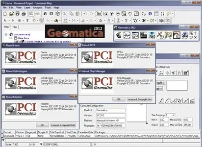
Name: PCI Geomatica
Version: 2012 SP1 32bit & 64bit
Creator: www.pcigeomatics.com
Interface: english
OS: Windows XP / Vista / Seven
Size: 211.3 mb & 267.1 mb
No mirrors please