

ESRI ArcGIS Pro 1.2 with Data Interoperability

ESRI ArcGIS Pro 1.2 with Data Interoperability | 1.5 Gb
ESRI is pleased to announce the availability of ArcGIS Pro 1.2. This release includes a vast set of new features and enhancements.
What's new in ArcGIS Pro 1.2
Highlights
Three licensing options
Before the 1.2 release, the only licensing option available for ArcGIS Pro was through Named User licensing. This license model required authorization through your organization administrator in your ArcGIS Enterprise portal or ArcGIS Online. At 1.2, you now have two new licensing models available that don't require you to go through ArcGIS Enterprise or ArcGIS Online: Single Use and Concurrent licensing. With a Single Use license, ArcGIS Pro points to a file for authorization. The file is stored on the same machine that runs ArcGIS Pro. With Concurrent licensing, a given number of licenses are hosted on a License Manager (the ArcGIS License Server Administrator). ArcGIS Pro is then configured to allow organization members to check out an available license from the pool of licences hosted on the License Manager.
Vector tiles
ArcGIS Pro 1.2 introduces vector tile creation. Vector tiles, like image tiles, are stored on a server and are used to draw data quickly at multiple scales. Rather than drawing pixels like image tiles, vector tiles store generalized representations of vector features. This means that vector tiles adapt to the resolution of the display of whatever device they are drawn on. The styling of vector tiles can be specified without re-creating tiles, and vector tiles can adapt to rotation, meaning that labels remain readable even when the orientation of the data changes.
Vector tiles are global basemap tile services for use with the ArcGIS configurable web apps and custom apps built with the ArcGIS API for JavaScript. Vector tile layers can be added to web maps as operational or basemap layers. They are created in ArcGIS Pro using the Create Vector Tile Package geoprocessing tool. The resulting vector tile package (*.vtpk file) can be published to ArcGIS Online or an ArcGIS Enterprise portal.
In support of vector tile creation, you can specify the scale range at which individual symbol classes are drawn when they are categorized by unique value or graduated colors. This can limit the amount of detailed data that draws at smaller scales—resulting in smaller tiles—without having to duplicate data in multiple layers.
Share layers that reference registered data
When sharing to an ArcGIS Enterprise portal, you can now share map image layers that reference registered data sources. With this option enabled, changes to your source data are instantly visible in your web layer—there is no need to overwrite the web layer to gather data updates.
Map image layers can be shared with associated feature and WMS layers. And they can be shared to any federated server to which you have access.
The alternative to referencing registered data is copying the data to the server. After the data is copied to the server and the web layer is shared, you can make updates to a local copy of the data before overwriting the previously shared data and web layer on the server. You control when the updates are moved to the server and exposed.
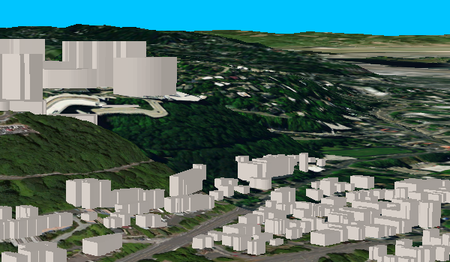
Publish 3D local scenes to ArcGIS Online and ArcGIS Enterprise
Web scenes can now be shared from a local view using a projected coordinate system. This is useful for projected datasets and when you have existing basemaps in the same projected coordinate system. The local web scene can be viewed in both ArcGIS Pro and the scene viewer.
ESRI ArcGIS Pro 1.2 with Data Interoperability
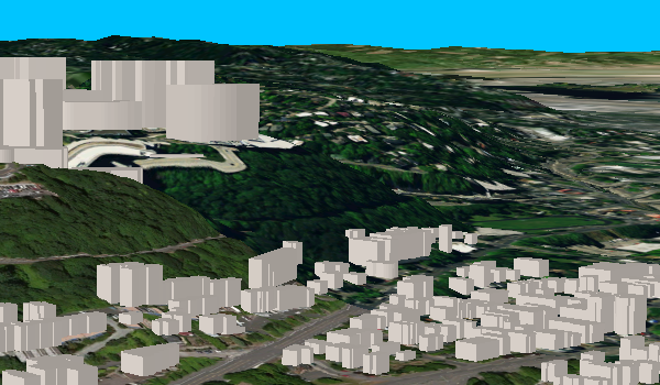
Publish 3D point layers as web scene layers to ArcGIS Enterprise portals
3D point layers can now be shared as scene layers to ArcGIS Enterprise portals. This enables improved visualization and performance of large point datasets including preset symbols. 3D point layers can be shared as individual web scene layers or as part of a web scene and can be consumed back into ArcGIS Pro or in the scene viewer.

ESRI ArcGIS Pro 1.2 with Data Interoperability
BUG-000084883 The 'Ignore NoData in calculations' option in Zonal Statistics as Table tool is not honored when checked off, producing incorrect results.
BUG-000085114 The 'Add Value' button is missing on Remove Domain From Field and Add Attribute Index tool.
BUG-000085208 Resolution options for conflicting edits, which contain deleted edits, are inactive in the Conflict Manager Window in ArcGIS Pro.
BUG-000085281 ArcEngine .NET COM+ Application failed in the 10.3 version.
BUG-000085364 "Input Features" in Create TIN tool is hard-coded.
BUG-000085594 In the ArcGIS Pro Import 3D Files geoprocessing tool parameters, the Symbol Field is marked as required even though the tool can be run without it, but documentation notes this field is optional.
BUG-000085672 Relates behave inconsistently in ArcGIS Pro
BUG-000085702 Maplex does not display some UTF-8 Japanese characters without additional characters in the string
BUG-000085719 Adding values to a blank Symbol Group and trying to modify the symbol properties of the added value returns an error.
BUG-000085751 ArcGIS Pro can’t display netCDF raster layers correctly, in Japanese.
BUG-000086163 The fields view does not refresh when fields are added or removed using the attribute table.
BUG-000086269 Reclassify generates incorrect number of classes for a 64bit raster.
BUG-000086775 In ArcGIS Pro 1.0 (French), the INSERTION tab changes to INSERT when a new layout is added to a project.
BUG-000086820 Tools that use the Topology Engine fail and, on a second run, crash if run on a computer with a Korean language operating system while running with a Korean named user license. Works as expected if logged in with an English named user license.
BUG-000086947 Splined text (made from the Draw Toolbar) saved in ArcMap with the Vertical Alignment changed to Top or Center will be converted to normal text and moved to the bottom left of the layout in ArcGIS Pro.
BUG-000087121 Unable to use the Register Raster tool with an ArcGIS Pro Basic license.
BUG-000087234 After executing the Add GlobalIDs geoprocessing tool, the GlobalID field doesn't appear to be added to a feature class or table until ArcGIS Pro is closed and re-opened.
BUG-000087447 ArcGIS Pro does not recognize the Jerusalem time zone, resulting in non-functionality of illumination options for global and local scenes.
BUG-000087515 ArcGIS Pro error in source: wrong variable name 'CIMMapDocuent.'
BUG-000087764 Dissolving a large polygon feature class crashes ArcMap with no error information.
BUG-000087949 All properties of a 3D layer are not retained when importing globe document into ArcGIS Pro.
BUG-000088314 Missing word wrap in Layer properties - Time settings in German ArcGIS Pro.
BUG-000088315 Activating time on an OPeNDAP Raster Layer causes ArcGIS Pro to crash.
BUG-000088319 Buffering irregular shaped polygon returns inconsistent results.
BUG-000088504 An option to add a leader line does not exist for paragraphs or text with bounding geometry in the layout view of ArcGIS Pro.
BUG-000088997 Grouping map elements and renaming the group displays html tags in the text.
BUG-000089050 Editing new code and value when connected user didn't own domain should not be allowed.
BUG-000089240 In ArcGIS Pro, running the Buffer tool on a specific feature creates an invalid polygon hole.
BUG-000089390 The Measure Area tool line is not rendered in ArcGIS Pro 1.1.
BUG-000089455 In ArcGIS Pro, the ASCII 3D To Feature Class tool displays the following error: "ERROR 000735: Average Point Spacing: Value is required" before the tool is run and when the Help feature states this parameter is optional.
BUG-000089460 ArcGIS Pro 1.1 does not display projection parameters for a custom projection correctly.
BUG-000089524 Dropdown list for Split Policy and Merge Policy in domain are not loading the resources correctly in the localized ArcGIS Pro.
BUG-000089527 The message "Warning: map surrounds exist" is a hard coded string and cannot be localized.
BUG-000089559 When attempting to add a secure service with stored credentials to ArcGIS Pro, error 404 occurs.
BUG-000089579 ArcGIS Pro crashes when selecting the 'Callout to center' extent indicator style.
BUG-000089666 There is no option to recalculate or delete a spatial index in ArcGIS Pro when working with a SQL Server enterprise geodatabase through the Feature Class properties menu.
BUG-000089686 In ArcGIS Pro, the WHERE clause SQL query for the Make Table View tool fails to create a subset.The attribute table of the table view shows the subset but ArcPy cursors are still able to access all records.
BUG-000089748 ArcGIS Pro stops responding while populating the Obstructions parameter.
BUG-000089793 Unique Value symbology Add new value to Feature Service shows up as a semicolon if the new added value contains spaces.
BUG-000089806 String "Locator Properties" is hard-coded in localized ArcGIS Pro
BUG-000089864 Cartographic (elevation) offset is not honored for mosaic datasets in ArcGIS Pro.
BUG-000089864 Cartographic offset is not displayed for Mosaic Datasets in ArcGIS Pro.
BUG-000089999 In ArcGIS Pro, using a subset selection of an SDE feature class as a geoprocessing input calls a large number of ‘LogOpenByLoginfo’ commands.
BUG-000090005 ArcGIS Pro 1.1 crashes when using Vector Field raster function on NetCDF files with u and V variables.
BUG-000090074 "Find tools" for geoprocessing tools in Task Designer is not translated.
BUG-000090142 ArcGIS Pro cannot connect to Oracle user-schema geodatabases.
BUG-000090150 Embedding a Space Time Pattern Mining Tool (STPMT) in a Task step in ArcGIS Pro is not saved.
BUG-000090225 The labels for any Raster Functions in the Functions Pane are not displayed in ArcGIS Pro 1.1 on Japanese Windows OS.
BUG-000090437 ArcGIS Pro Software Update may fail to update Python or ArcGIS Pro Help on machines that have Pro 1.1 and a Pro 1.0 language pack installed.
BUG-000090444 ArcGIS Pro crashes when providing directions for a route analysis layer if the numeric format (user locale) is set to German, French or other European languages.
BUG-000090449 Some Python Raster Functions do not work with ArcGIS Pro 1.1.
BUG-000090450 Some Scene layers can be incorrectly placed in the "2d Layers" group upon loading certain Web Scenes.
BUG-000090474 The add-In registration utility (RegisterAddIn.exe) fails to register add-ins on some comma delimited locales, including Finnish.
BUG-000090617 Modifications to a domain are not saved in ArcGIS Pro 1.1 when the French language pack is installed.
BUG-000090806 Only the first address of a .xls or .xlsx file is successfully geocoded in ArcGIS Pro.
BUG-000090809 In ArcGIS Pro, task steps do not save the script tool of a Python toolbox.
BUG-000090832 The extent indicator does not recognize the map frame rotation in ArcGIS Pro 1.1.
BUG-000090926 ArcGIS Pro stops responding when attempting to print to Brother Printers.
BUG-000091128 SelectLayerByAttribute_management's CLEAR_SELECTION does not work via a script tool in ArcGIS Pro 1.1.1.
BUG-000091137 Geoprocessing tools fail if an input layer shares the same name as a map in the same project.
BUG-000091153 The Generate File Geodatabase License, Generate Licensed File Geodatabase, and Register Raster geoprocessing tools are unavailable with an ArcGIS Pro Basic license.
BUG-000091186 Layers in a three-level deep group layer do not work with geoprocessing tools.
BUG-000091269 ArcGIS Pro Arcpy documentation says a layer's dataSource property is 'read only,' though it is 'read and write'.
BUG-000091426 ArcGIS Pro crashes when using a raster as an input to the Layer to KML geoprocessing tool.
BUG-000091520 String "Export Map" is concatenated and caused the wrong translation.
BUG-000091611 ArcGIS Pro is unable to populate legends with feature symbology from map services.
BUG-000091638 Customizing the ArcGIS Pro ribbon with "Create new selection/Add to Current Selection" commands crashes the application.
BUG-000091651 The Copy command for a task group and a task creates duplicate steps in the copied task in certain scenarios.
BUG-000091667 Search cursor for a file geodatabase feature class in ArcGIS Pro is slower compared to in ArcObjects.
BUG-000091671 String "SQL Expression is valid" has double periods in the source.
BUG-000091760 Geographically small polygons are not labeling with Maplex
BUG-000091811 Texts are truncated in label class panel with French ArcGIS Pro 1.2.
BUG-000091816 A label text shows dynamic behavior when zooming in and out of the layout page in ArcGIS Pro.
BUG-000091816 2D Labels text shows dynamic behavior when zooming in and out of the layout page in ArcGIS Pro.
BUG-000091821 In ArcGIS Pro, the Point symbology with a rotation based on an attribute does not correctly rotate when exported to a PDF.
BUG-000091862 The Use Suggestions settings are not maintained when changed in the Locate pane in ArcGIS Pro.
BUG-000091874 Opening a saved project in ArcGIS Pro after changing password prompts the user to input correct password.
BUG-000091900 Labels can scale to a smaller size when the layout is exported.
BUG-000091988 The property page for any Raster Function is empty in Russian ArcGIS Pro.
BUG-000092010 Default values are not honored in Attributes pane when adding new records to related tables.
BUG-000092025 String in Tasks Option is hard- coded in localized versions of ArcGIS Pro.
BUG-000092031 New or Renamed models do not appear in Task Actions until ArcGIS Pro is closed and reopened.
BUG-000092038 When switching the map frame in a layout, the legend breaks and cannot be fixed.
BUG-000092091 ArcGIS Pro attribute table and map window do not refresh after running some geoprocessing tools that modify multi-user geodatabase versioned data.
BUG-000092298 In some cases when a datum transformation is added to the map due to the user adding a layer, it is not applied until the map is reopened.
BUG-000092312 3D labels text show dynamic behavior when zooming in and out on layout page in ArcGIS Pro.
BUG-000092402 In ArcMap 10.3.1, adding a netCDF file created in ArcGIS Pro with the Template Cube in the Create Space Time Cube tool returns the error, "The Reference Cube provided was created using an old version of Create Space Time Cube that has a serious logical flaw."
BUG-000092454 In ArcGIS Pro, geocoding an address in Prague gives an incorrect location when the data frame coordinate system is set to S-JTSK Krovak East North, but gives the correct location when set to Web Mercator (auxiliary sphere).
BUG-000092608 Exported raster statistics couldn't be imported with decimal separator in German (Austria) country setting.
BUG-000092675 The Geocode Addresses tool in ArcGIS Pro does not recognize an ArcGIS for Server geocode service which is published to a folder other than the root folder.
BUG-000092751 Maplex Label engine crashes at this extent when labeling fixed position in polygons.
BUG-000092765 Chinese characters are not represented correctly when converting a JSON file to a feature class using a geoprocessing service published to ArcGIS for Server on Linux or SUSE Linux.
ENH-000083743 The NDVI function is missing the option to create ‘Scientific Output.'
ENH-000088173 Please provide an option to choose units for extrusion values instead of applying extrusion in meters.
NIM063222 When the Description and Use Limitation elements in an item’s metadata have formatted text, spaces are removed between bold or italic text and the adjacent words, and also between hyperlinks and other words in the same paragraph.
NIM064365 When you try to underline text in the Description (Abstract) and Use Limitation elements in an item’s metadata, the underline formatting is not saved along with other changes you made to the item’s metadata.
NIM090106 Dissolve with Single Part option failing or generating incorrect output when run from 32bit Desktop only.
NIM093558 ITopologicalOperator.Intersect() returns the wrong number of intersection points for certain geometries ("lasso-shaped" geometries) while using esriGeometry0Dimension.
NIM100173 Point and line data cannot set Transparency option on symbol advanced setting.
NIM100595 ArcGIS Pro Does not display Japanese era name correctly.
ESRI ArcGIS Pro 1.2 with Data Interoperability
ArcGIS is a platform for organizations to create, manage, share, and analyze spatial data. It consists of server components, mobile and desktop applications, and developer tools. This platform can be deployed on-premises or in the cloud (Amazon, Azure) with ArcGIS Enterprise, or used via ArcGIS Online which is hosted and managed by Esri.
ArcGIS Pro is a modern, fast, and powerful GIS application for building beautiful maps in 2D and 3D, analyzing your data, and authoring geographic knowledge. This gives you the power to examine relationships, test predictions, and ultimately make better decisions.
ArcMap vs ArcGIS Pro - Comparing these two GIS applications from Esri
Esri is the global market leader in geographic information system (GIS) technology, location intelligence, mapping software, and spatial analytics. Esri software is deployed in more than 350,000 organizations and 75 percent of Fortune 500 companies. The world’s largest cities, most national governments, and more than 7,000 colleges and universities use Esri technology to improve operational and business results. Since 1969, Esri has helped customers unlock the full potential of data with its pioneering commitment to geospatial information technology. Esri builds ArcGIS, the world’s most powerful geospatial cloud platform, and engineers the most advanced solutions for digital transformation, the Internet of Things (IoT), and advanced analytics.
Product: ESRI ArcGIS
Version: Pro 1.2 with Data Interoperability
Supported Architectures: 32bit / 64bit
Website Home Page : https://desktop.arcgis.com/
Language: english
System Requirements: PC *
Supported Operating Systems: *
Size: 1.5 Gb
Supported operating systems
Windows 10 Home, Pro and Enterprise (64 bit [EM64T])
Windows 8.1 Basic, Pro, and Enterprise (32 bit and 64 bit [EM64T])
Windows Server 2019 Standard and Datacenter (64 bit [EM64T])
Windows Server 2016 Standard and Datacenter (64 bit [EM64T])
Windows Server 2012 R2 Standard and Datacenter (64 bit [EM64T])
Windows Server 2012 Standard and Datacenter (64 bit [EM64T])
Hardware requirements
CPU speed: 2.2 GHz minimum; Hyper-threading (HHT) or Multi-core recommended
Platform: x86 or x64 with SSE2 extensions
Memory / RAM:
Minimum: 4 GB
Recommended: 8 GB or higher
ArcGlobe may require 8 GB minimum when used.
Display properties: 24-bit color depth
Screen resolution: 1024x768 recommended minimum at normal size (96 dpi)
Disk space:
Minimum: 4 GB
Recommended: 6 GB or higher
ArcGlobe creates cache files when used. If using ArcGlobe, additional disk space may be required.
Video/Graphics adapter:
64 MB RAM minimum; 256 MB RAM or higher recommended. NVIDIA, ATI, and Intel chipsets supported.
24-bit capable graphics accelerator
OpenGL version 2.0 runtime minimum is required, and Shader Model 3.0 or higher is recommended.
Be sure to use the latest available drivers
Please visit my blog
Added by 3% of the overall size of the archive of information for the restoration
No mirrors please

![ESRI ArcGIS Pro 1.2 with Data Interoperability]()
Added by 3% of the overall size of the archive of information for the restoration
No mirrors please
ESRI ArcGIS Pro 1.2 with Data Interoperability
