


Civil Survey Solutions Civil Site Design 24.0

Civil Survey Solutions Civil Site Design 24.0 | 1.4 Gb
Civil Survey Solutions, a Silver Partner of Autodesk, is pleased to announce the availability of Civil Site Design V24.0. This software provides you with highly efficient and simple-to-use civil design tools for road and corridor based projects, land development and site grading, stormwater, sewer and pipe design.
Civil Site Design 24.0 what's new
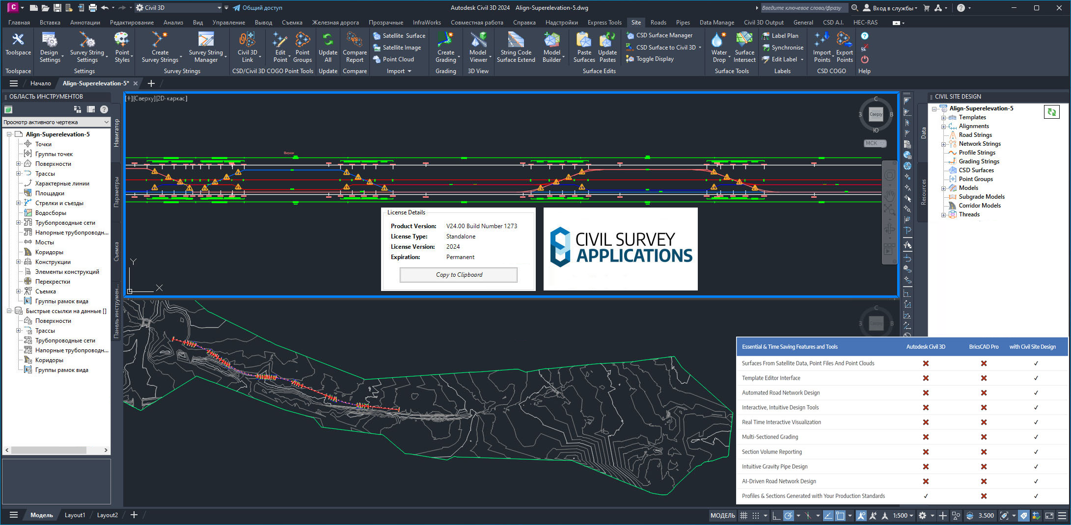
A Civil Site Design Toolspace has been developed from which users can design and edit & manage the roads and modelling content within their projects. The dockable palette will give users the benefit of contextually being able to access the majority of civil site design functionality via the toolspace which would normally be found in multiple ribbon tabs.
Found in the Toolspace, users can now create Civil Site Design surfaces from 2D objects in the drawing. This feature is great for designers in receipt of 2d survey data - where no 3D information is present. Creating CSD cogo points from your 2d data, Civil Site Design immediately builds a surface and enables users to being designing faster.
The template editor has undergone a visual refresh with some additional options to now change the display and manage the sharing of templates. Found under the file pulldown, the template packing provides teams with the ability to exchange selections of templates and store them for specific local authorities or stakeholders.
Model Viewer now includes some terrain analysis features which will shade your civil site Design and Civil 3D surface elevations and highlight road slope and crossfall ranges.
A selection of Catchment analysis tools has also been added where users can now analyse and display ponding, catchments and low points within any surface in civil site design, outputting the analysis back to the drawing.
Civil Survey Solutions Civil Site Design 24.0
Originally built for Civil 3D and now expanded to operate on AutoCAD and BricsCAD, Civil Site Design provides you with highly efficient and simple-to-use civil design tools for road and corridor based projects, land development and site grading, stormwater, sewer and pipe design. Built for all civil designers, you can quickly and easily generate road network designs complete with dynamic intersections and cul-de-sacs, updating as you make changes to any element. The software is also purpose built for road reconstruction designers. Civil Site Design supports multiple platforms and multiple product releases: Civil Site Design has been developed to operate on AutoCAD, Map 3D and Civil 3D from 2012 to the latest release, and recently has been updated to operate on BricsCAD.
Civil Site Design V24 has been released featuring many new and improved features to coincide with the Autodesk 2024 release.
Civil Site Design V24 | Highlights
Civil Survey Solutions is an Autodesk Partner specialising in the Civil Engineering/Survey industry. We provides sales, implementations, technical support and training for AutoCAD and AutoCAD Civil 3D. Also as an Autodesk developer, Civil Survey Solutions have developed applications to enhance the CAD environment with products such as Civil Site Design and Stringer, which is being used world wide by designers. Civil Survey Solutions aims to deliver superior technical support and customer service - offering a quality developed product with exceptional value, for both the Civil Engineering Designers and Surveyors Industry Applications developed by Civil Survey Solutions - Civil Site Design - Stringer Topo - Stringer ePlan - Stringer ASpec - Site Leveller Autodesk Products - AutoCAD - AutoCAD Civil 3D.
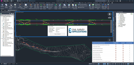
Product: Civil Survey Solutions Civil Site Design
Version: 24.0 (1273) for Autodesk Civil 3D 2015 - 2024
Supported Architectures: x64
Website Home Page : https://civilsitedesign.com/
Languages Supported: english
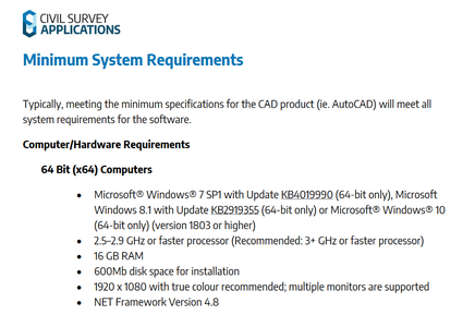
System Requirements: Windows *
Size: 1.4 Gb
Civil Survey Solutions Civil Site Design 24.0
Please visit my blog
Added by 3% of the overall size of the archive of information for the restoration
No mirrors please

![Civil Survey Solutions Civil Site Design 24.0]()
Added by 3% of the overall size of the archive of information for the restoration
No mirrors please
Civil Survey Solutions Civil Site Design 24.0
