

Aquaveo Groundwater Modeling System (GMS) 10.8.7
Aquaveo Groundwater Modeling System (GMS) 10.8.7 | 945.1 mb
Aquaveo, a water resources consulting company, is pleased to announce availability Groundwater Modeling System (GMS) 10.8.7 is the most advanced software system available for performing groundwater simulations in a three-dimensional environment.
What's New in GMS 10.8.7 - Date: September 09, 2024
Coverage
- 15247 Clean results in invalid arcs (two segments on top of each other).
Display
- 15303 Isosurface legend doesn’t update after changing “Float format” options in display options.
Feature Objects
- 15235 UZF attributes don't map from shapefile.
MODFLOW6
- 15249 MF6 MDT 3D project fails to run with inconsistent error messages.
- 15200 MF6 CHD Package Time-series files add row generates unexpected error.
Projection
- 15334 Projection for *.asc Raster Filesnot handled correctly.
UGrid
- 15321 Elevation count not matching point count error when deleting UGrid cells.
- 15309 GMS crashes when changing UGrid constraint.
- 15283 Changing constraint type on UGrids causes layering to disappear.
- 15274 Translating a UGrid is changing its coordinates to NaN.
Aquaveo Groundwater Modeling System (GMS) 10.8.7
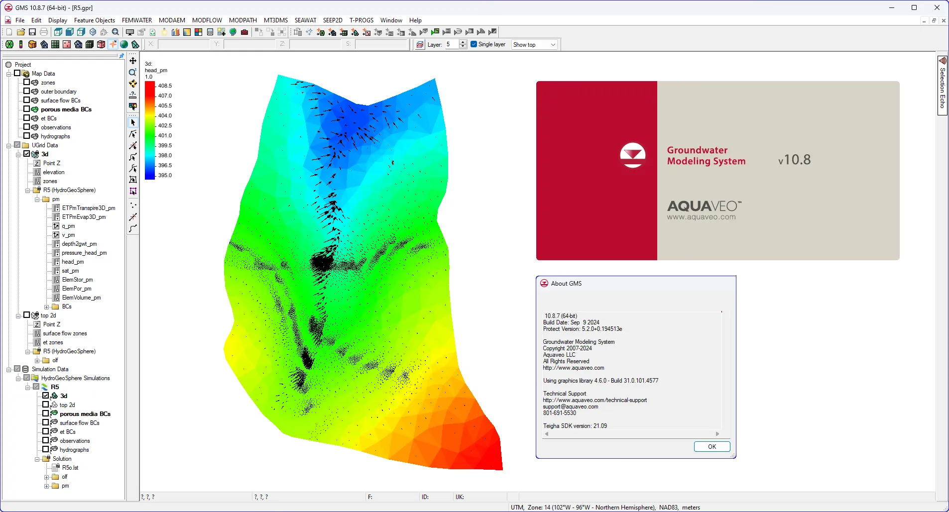
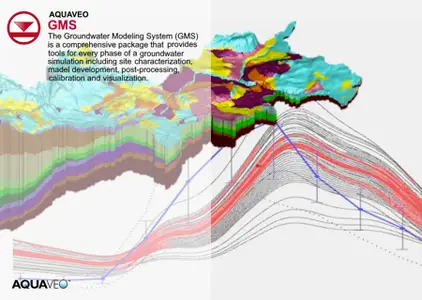
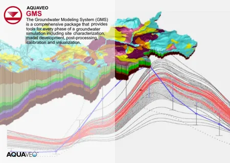
The Groundwater Modeling System (GMS) is a comprehensive graphical user environment for performing groundwater simulations. The entire GMS system consists of a graphical user interface (the GMS program) and a number of analysis codes (MODFLOW, MT3DMS, etc.). GMS was designed as a comprehensive modeling environment. Several types of models are supported and facilities are provided to share information between different models and data types. Tools are provided for site characterization, model conceptualization, mesh and grid generation, geostatistics, and post-processing.
GMS
Instructional videos for the Groundwater Modeling System (GMS) program developed by Aquaveo.
Aquaveo is a pioneer of GIS-based software solutions for hydraulic, hydrologic and groundwater modeling. Our products have been refined over two decades to create the most advanced environmental modeling and visualization software available. In addition to interfacing with industry standard numerical models, we develop custom desktop and cloud-based applications tailored to specific needs. Aquaveo began as a part of the Engineering Computer Graphics Laboratory at Brigham Young University in 1985. The lab was reorganized and the name was changed in September, 1998 to the Environmental Modeling Research Laboratory (EMRL). In April, 2007, the main software development team at EMRL entered private enterprise as Aquaveo, LLC.
Owner: Aquaveo
Product Name: Groundwater Modeling System (GMS)
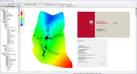
Version: 10.8.7 Premium
Supported Architectures: x64
Website Home Page : www.aquaveo.com
Languages Supported: english
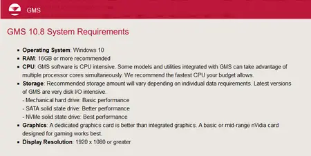
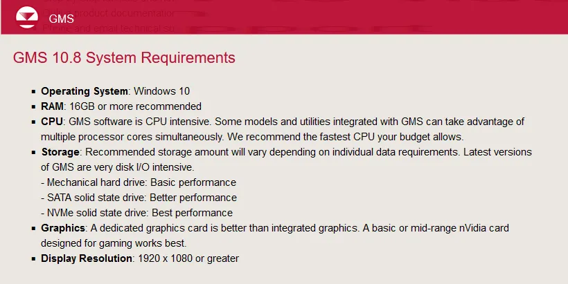
System Requirements: Windows *
Size: 945.1 mb
Aquaveo Groundwater Modeling System (GMS) 10.8.7
Please visit my blog
Added by 3% of the overall size of the archive of information for the restoration
No mirrors please

![Aquaveo Groundwater Modeling System (GMS) 10.8.7]()
Added by 3% of the overall size of the archive of information for the restoration
No mirrors please
Aquaveo Groundwater Modeling System (GMS) 10.8.7
